- Популярные видео
- Авто
- Видео-блоги
- ДТП, аварии
- Для маленьких
- Еда, напитки
- Животные
- Закон и право
- Знаменитости
- Игры
- Искусство
- Комедии
- Красота, мода
- Кулинария, рецепты
- Люди
- Мото
- Музыка
- Мультфильмы
- Наука, технологии
- Новости
- Образование
- Политика
- Праздники
- Приколы
- Природа
- Происшествия
- Путешествия
- Развлечения
- Ржач
- Семья
- Сериалы
- Спорт
- Стиль жизни
- ТВ передачи
- Танцы
- Технологии
- Товары
- Ужасы
- Фильмы
- Шоу-бизнес
- Юмор
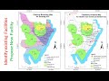
Google Earth Engine Tutorial 7: How to Save Image and Prepare Map Using ArcGIS
Greetings!!
Welcome to @GISRSSolution
In the last video, we learned how to prepare an air quality monitoring map for NO2 concentration. We covered downloading and importing data, filtering data, reducing the image collection, clipping the image based on the study area, and displaying the results on the GEE platform.
In this video, I will show you how to save the results to your computer from GEE and create a beautiful map using ArcMap. I believe this video will be very helpful for those using GEE. I hope you find it useful. I will share the script in the comment section.
Script: https://code.earthengine.google.com/526cc6202d8853b2694917c6b5aa8b46?hl=it
Видео Google Earth Engine Tutorial 7: How to Save Image and Prepare Map Using ArcGIS канала GIS & RS Solution
Комментарии отсутствуют
Информация о видео
8 ноября 2024 г. 14:15:00
00:09:13
Другие видео канала