ArcGIS Pro 2.2–AI & Machine Learning
Two new geoprocessing tools infused with machine learning in ArcGIS Pro 2.2 – density-based clustering and forest-based classification and regression – make analysis and prediction with ML more accessible to GIS professionals. Learn more here: https://pro.arcgis.com/en/pro-app/tool-reference/spatial-statistics/how-forest-works.htm.
See More 2018 Esri User Conference Plenary - http://p.ctx.ly/r/7zha
--------------------------------------------------------------------------------------------------------------------------
Follow us on Social Media!
Twitter: https://twitter.com/Esri
Facebook: https://facebook.com/EsriGIS
LinkedIn: https://www.linkedin.com/company/esri
Instagram: https://www.instagram.com/esrigram
The Science of Where: http://www.esri.com
Видео ArcGIS Pro 2.2–AI & Machine Learning канала Esri Events
Показать
Комментарии отсутствуют
Информация о видео
Другие видео канала
 Artificial Intelligence and Machine Learning with ArcGIS
 Machine Learning in ArcGIS
 Boston Planning & Development Agency: A New Revolution in Urban Planning
 When deep learning meets satellite imagery
 What is Artificial Intelligence (or Machine Learning)?
 Welcoming Our Global Users
 How to extract contour lines And DEM from Google Earth
 Just how easy is Python programming in ArcGIS Pro? You only need 7+2 commands for this tool!
 Machine Learning dans QGis : Classification d'Image
 Exploring a LiDAR LAS dataset in ArcGIS Pro
 COVID-19 Response: CHIME Model Introduction
 【今さら聞けない】グーグルマップの使い方!基本操作から便利機能まで紹介!【基本編】|スマホ比較のすまっぴー
 Creating database, subtypes, topology and map digitalization in ArcGIS PRO (update 20.4.21)
 Integrating Machine Learning and Deep Learning with ArcGIS
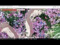 Measuring Impact with Remotely Sensed Imagery and Machine Learning
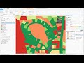 ArcGIS Pro: Machine Learning Classification for Impervious Surfaces
![QGIS tutorial: Google Earth Engine plugin [EN]](https://i.ytimg.com/vi/RNbzhlMHekU/default.jpg) QGIS tutorial: Google Earth Engine plugin [EN]
QGIS tutorial: Google Earth Engine plugin [EN]
 Better Medicine Through Machine Learning | Suchi Saria | TEDxBoston
 Joins and Relates - Geogrphic informations system ARCGIS - ESRI - GIS