BEST FREE websites for mapping | Free base map files for site analysis
Creative mapping is becoming an integral part of the architecture and landscape design practice. In this video, we listed 7 top sites to get free base maps for our architecture, landscape architecture, or urban design site analysis and mapping.
Also check: 10 websites to download FREE cut out PNG People and Trees
https://youtu.be/L7fM9EhPoLA
1. Weather visualization: https://www.ventusky.com/
2. SVG city map: https://www.openstreetmap.org/
3. Custom online maps: https://www.mapbox.com/
4. Free city CAD map and 3D Sketchup/Rhino files: https://cadmapper.com/
5. Free contour map generator: https://contourmapgenerator.com/
6. Free interactive population visualization map: https://pudding.cool/2018/10/city_3d/
7. Interactive sea level rise and flooding maps: https://sealevel.climatecentral.org/
Subscribe and share with your friends!
Mapping tutorials collection: https://www.youtube.com/watch?v=SvvL7PdOzms&list=PLVFzw6ry9N366jtlpA3B6fvgeQT8F04gi
Instagram: https://www.instagram.com/landspace.arch
Facebook: https://www.facebook.com/landspacearch
Follow our Pinterest for more inspirations: https://www.pinterest.com/landspacearch/
#urbandesign #landscapearchitecture #illustratorarchitecture
Видео BEST FREE websites for mapping | Free base map files for site analysis канала Land Space Architecture
Показать
Комментарии отсутствуют
Информация о видео
Другие видео канала
 Google Earth Master Plan in Photoshop
 Human Population Through Time
 7 (more) Best Sites to Help us be Better Architects (Site map, Vector human figures, Norman foster)
 7 FREE Websites for Better Site Analysis in Architecture
 How the World Map Looks Wildly Different Than You Think
 How to create a Figure Ground Drawing with Mapbox
 Three Ways To Import OpenStreetMap Data In SketchUp
 Site Modeling in SketchUp
 20 Photoshop Tips, Tricks & Secrets for Architecture
 Architecture Site Analysis – The Site Analysis Course for Beginners
 How I Make My Maps
 3 FREE Digimap Alternatives for Site Analysis and Site Plans
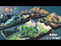 How to Create 3D Terrain with Google Maps and Blender!
 Topography for any Site with CADmapper - Revit Tutorial
 Openstreetmaps to Illustrator
 5 Free Map Tools for Dungeon Masters
 How to extract contour lines And DEM from Google Earth
 Site Analysis in Architecture/Urbanism
 9 Illustrator Tips every Architect must know!
 BIG's Concept Diagrams in Architecture