REACHOUT, shaping climate resilient cities
Join us on the REACHOUT-journey in this video and see how climate resilient cities shape and adapt. REACHOUT is a European Commission funded project supporting the Green Deal. Learn how research partners, climate service providers and EU-cities (Milan, Logroño, Cork, Lillestrøm, Gdynia, Athens) work closely together to develop a Triple A-toolkit for climate adaptation. The Triple-A approach is based on proven success and tool sets from cities across the world. The REACHOUT-project develops city ‘story maps’ translating climate science into accessible information for local officials, water experts, advisors, citizens and companies. REACHOUT brings together a highly experienced transdisciplinary team with comprehensive knowledge on climate change adaptation, climate services and experience in working in cities. Our consortium aims to engage citizens and the private sector through active participation in dealing with climate-related impacts.
Go to http://www.reachout-cities.eu for more info.
Or get in touch with us: info@reachout-cities.eu
Follow us on Twitter, Instagram and LinkedIn
LinkedIn: http://www.linkedin.com/company/reachout-cities
Twitter: http://twitter.com/REACHOUT_cities
Instagram: http://www.instagram.com/reachout_cities/
Видео REACHOUT, shaping climate resilient cities канала Deltares
Показать
Комментарии отсутствуют
Информация о видео
Другие видео канала
 Flow patterns around the Eastern Scheldt tidal turbines during flood
 Toename zoutvracht naar oppervlaktewater
 From Space to Sea1
 Mindert de Vries over de FAST Tool
 Deltares Particle tracking forecasting in German Bight by using Delft-FEWS
 Samenwerking Deltares – Rijkswaterstaat Kennis voor slib in de Eems-Dollard
 Deltares Schatten van de Noordzee
 iMOD plugin for QGIS - a demonstration of the widget to view timeseries data
 iD-Lab Interactive data research laboratory
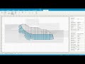 D-Stability-Inspect calculation result
 Irregular Wave - Improved design methods for floating offshore wind
 waterkwaliteit
 Webinar: Quantifying vegetation dynamics for designing and managing nature based solutions
 Diagram Nexus Ecology, Water, Energy, Food
 Opening ceremony iD-Lab Deltares
 Meerlaagsveiligheid: De Riscobenadering
 The DeltaFlume of Deltares: the highest artificial waves in the world.
 Rotterdam, Nieuwe Maas (joint Rhine-Meuse River mouth) - 3D interactive modelling using Delft3D FM
 DSD-INT 2017 - River Basin Planning And Modelling Symposium - Webinar Session 20171025
 TKI Climacs
 Adaptation Pathways