- Популярные видео
- Авто
- Видео-блоги
- ДТП, аварии
- Для маленьких
- Еда, напитки
- Животные
- Закон и право
- Знаменитости
- Игры
- Искусство
- Комедии
- Красота, мода
- Кулинария, рецепты
- Люди
- Мото
- Музыка
- Мультфильмы
- Наука, технологии
- Новости
- Образование
- Политика
- Праздники
- Приколы
- Природа
- Происшествия
- Путешествия
- Развлечения
- Ржач
- Семья
- Сериалы
- Спорт
- Стиль жизни
- ТВ передачи
- Танцы
- Технологии
- Товары
- Ужасы
- Фильмы
- Шоу-бизнес
- Юмор
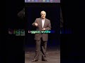
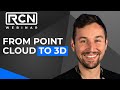
Advancing Geospatial Workflows
The value of reality capture is not just in the data, it is in how teams use it. In this Geo Week presentation, CDM Smith shares how LiDAR, drones, 360 imagery, and XR technologies are helping engineers improve safety, reduce field time, and make better decisions across complex infrastructure projects.
From dam inspections to water treatment facilities, this session highlights how immersive digital environments are changing the way projects are planned, designed, and delivered.
Watch the full presentation in the RCN Collective Classroom: www.joinrcn.com
#GeoWeek #XR #RealityCapture
Видео Advancing Geospatial Workflows канала Reality Capture Network
Комментарии отсутствуют
Информация о видео
16 июня 2026 г. 1:15:43
00:00:36
Другие видео канала