Propeller Aeropoints | Let's find out if they work
Gary goes on location with 3Dronemapping and Propeller Aero to test out Propeller Aero's Aeropoints ground control system for aerial surveys.
The results are in, check out this post
https://www.suasnews.com/2017/06/investigating-geometric-accuracy-propeller-aeropoints-propeller-cloud-processing/
Background music: Alex Tone - Africa (Original Mix) https://soundcloud.com/emprize/alex-tone-africa-original-mix
Presenter: Gary Mortimer
Video production/editing: Tiaan Roux
Stay informed and learn how to earn in the Business of Drones.
Don't miss out on any of our latest videos, subscribe https://goo.gl/PMFYQb
Other places you can find us:
https://www.suasnews.com
https://www.facebook.com/suasnews
https://www.twitter.com/suasnews
http://www.suasnews.com/suasguide
Видео Propeller Aeropoints | Let's find out if they work канала Drone & Sundry
Показать
Комментарии отсутствуют
Информация о видео
Другие видео канала
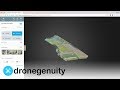 DroneDeploy Review - Aerial 3D Mapping Software
 RC test of fixed-wing drone with gasoline engine
 AeroPoints Essentials
 Detalhes incríveis desse aerolevantamento com Vant Ebee da Sensefly, decolagem e aterrissagem.
 Should You Use Propeller Aeropoints as Your Ground Control Points?
 Inside a Drone Factory in China. What's it like?
 Orthophotos Improved Using Fake Ground Control Points
 HUVIAiR The Ultimate Guide for Land Surveying with Drones (Definition of GCPs)
 Collecting Ground Control Points (GCPs) using GNSS (Episode 1: Why GCPs?)
 What is LiDAR Drone Surveying | Accuracies and Results
 How to do PPK Mapping on a Phantom 4 Pro using EZsurv and M+ from TuffWing.com
 Startup Guide for required Drone Mapping Equipment and how to use it
 ALTI Ascend The new benchmark for endurance VTOL drones
 Collecting Ground Control Points (GCPs) using GNSS (Episode 2: Equipment Setup and Data Collection)
 The 6 terrain lenses that help to create a drone survey
 Drones, Mines and Data
 Drone surveying tutorial with WingtraOne - Plan a flight, collect images and interact with the drone
 DRONE MAPPING & SURVEYING - How to use Portable Ground Control Points
 The Infinadeck Omnidirectional Treadmill - Smarter Every Day 192 (VR Series)