- Популярные видео
- Авто
- Видео-блоги
- ДТП, аварии
- Для маленьких
- Еда, напитки
- Животные
- Закон и право
- Знаменитости
- Игры
- Искусство
- Комедии
- Красота, мода
- Кулинария, рецепты
- Люди
- Мото
- Музыка
- Мультфильмы
- Наука, технологии
- Новости
- Образование
- Политика
- Праздники
- Приколы
- Природа
- Происшествия
- Путешествия
- Развлечения
- Ржач
- Семья
- Сериалы
- Спорт
- Стиль жизни
- ТВ передачи
- Танцы
- Технологии
- Товары
- Ужасы
- Фильмы
- Шоу-бизнес
- Юмор
4000 Year Old MAP No One Can Read #history #ancientrelics #facts
#Shorts #Archaeology #History #AncientMysteries #BronzeAge
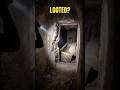
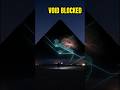
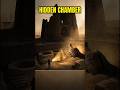
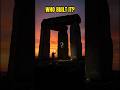
The 4,000-year-old Saint-Bélec slab remains one of archaeology's most baffling enigmas. Discovered in Brittany, France, this Bronze Age artifact features intricate carvings that experts believe represent a topographic map of the region. Despite its historical significance, researchers struggle to decipher the specific geography hidden within the stone. Is this a functional map used by ancient civilizations, or merely symbolic art representing their worldview? By comparing the Saint-Bélec slab to other ancient artifacts like the Babylonian Imago Mundi, we explore the intersection of early cartography, ideology, and lost knowledge. Why did our ancestors go to such lengths to etch complex geometric patterns into stone, and what does it reveal about their understanding of the world? Join us as we examine the physical evidence and the theories surrounding this mysterious relic. If you are fascinated by ancient mysteries, archaeological discoveries, and the secrets of the Bronze Age, this deep dive into the Saint-Bélec slab is for you.
Subscribe to Arcanix Files to help us uncover the history they left out.
Is the Saint-Bélec slab a map or symbolic art?
🔔 Subscribe @arcanix-files for more
Видео 4000 Year Old MAP No One Can Read #history #ancientrelics #facts канала Arcanix Files
Комментарии отсутствуют
Информация о видео
20 мая 2026 г. 22:00:34
00:01:53
Другие видео канала