- Популярные видео
- Авто
- Видео-блоги
- ДТП, аварии
- Для маленьких
- Еда, напитки
- Животные
- Закон и право
- Знаменитости
- Игры
- Искусство
- Комедии
- Красота, мода
- Кулинария, рецепты
- Люди
- Мото
- Музыка
- Мультфильмы
- Наука, технологии
- Новости
- Образование
- Политика
- Праздники
- Приколы
- Природа
- Происшествия
- Путешествия
- Развлечения
- Ржач
- Семья
- Сериалы
- Спорт
- Стиль жизни
- ТВ передачи
- Танцы
- Технологии
- Товары
- Ужасы
- Фильмы
- Шоу-бизнес
- Юмор
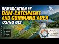
Reservoir Sedimentation Analysis using GIS & Remote Sensing | Civil Engineering
Every single dam that is constructed eventually loses its "Live Storage" capacity due to the gradual accumulation of silt and sediment carried by inflowing rivers. Traditionally, measuring this loss was a slow, incredibly expensive, and labor-intensive process using manual hydrographic surveys.
But today, we decode how GIS and Remote Sensing have revolutionized this process!
We will compare traditional topographic mapping with 3D digital surface modeling, understand how continuous raster modeling calculates precise volumes, and look at the power of "Data Layering" (overlaying soil types, land cover, and elevation data) to identify the root causes of watershed erosion.
📌 Key Concepts Covered in This Lesson:
• The mechanisms behind reservoir siltation and why it threatens dam lifespans.
• The difference between discrete, slow manual surveys and dynamic, automated GIS modeling.
• Utilizing continuous raster modeling for high-precision volume calculations.
• Using GIS Overlay Analysis (Soil, Land Cover, Elevation) to find the source of watershed erosion.
• How Remote Sensing allows proactive, annual water-resource check-ups.
#CivilTechnoBricks #CivilEngineering #ReservoirSedimentation #GIS #RemoteSensing #WaterResourceManagement #DamSafety #Hydrology #Siltation #HappyLearning #DecodingTheEarth
Видео Reservoir Sedimentation Analysis using GIS & Remote Sensing | Civil Engineering канала CiviL TechnO BrickS
Комментарии отсутствуют
Информация о видео
21 мая 2026 г. 18:50:22
00:20:09
Другие видео канала