Understanding Marine Buoyage - full volume - simple and easy www.coastalsafety.com
Buoyage with a "Captain" or "Navigator" perspective for a practical understanding. In the middle of a stormy night - when a buoy flashes, you need to know instinctively, what to do.
0:00 Intro
0:49 IALA regions (B) USA and (A) Rest of world)
2:01 safe water - safe navigation all around the buoy
2:37 isolated danger - small areas of danger
3:33 lateral - marking channels
4:40 special - other areas where various activities are / are not allowed
5:18 cardinal - indicating safe direction of navigation
6:28 North Cardinal
6:52 East Cardinal
7:19 South Cardinal
7:59 West Cardinal
8:22 Emergency Wreck Marker
9:08 More info on website www.coastalsafety
wrecks - submerged and partially submerged ships wrecks and danger
If you remember the 10 types of buoy - then it is easy to remember. Especially when you group the buoys together
LATERAL CHANNEL - marking channels (PORT & STARBOARD)
CARDINAL - indicating safe direction of navigation (North East South West)
ISOLATED DANGER (NO) - danger in the vicinity of the buoy
SAFE WATER (YES)- safe navigation all around the buoy
EMERGENCY WRECK (do not approach) - submerged and partially submerged ships wrecks and danger
SPECIAL (only approach if you know what is there)- other areas where various activities are / are not allowed
These are simple ways that we teach the basic foundations ... from which we build greater knowledge.
www.coastalsafety.com Subtitles available in Arabic, English, French, Hindi, Sinhala, Tagalog
Region A covers Europe and most of the of the world (red to port side).
Region B covers the America, Japan, the Philippines and South Korea (Green to port side).
Flash - less light & more darkness
Long flash - longer flash but still less light & more darkness
Isophase - equal time of light and darkness
Occulting - more light & less darkness
Nautical chart symbols
Aids to Navigation that have lights are marked on the chart with a small teardrop shape that will be magenta in colour (easy to read under a RED night vision light). The teardrop can point in various directions to best display on the chart and the actual direction drawn on the chart is of no significance..
LATERAL CHANNEL marks are used generally to mark the sides of well-defined, navigable channels.
They are positioned in accordance with the "Conventional Direction of Buoyage" as discussed above. Port and Starboard lateral marks tend to be can shaped on the port side and conical shaped on the starboard side - this makes them easier to identify in low light or reduced visibility conditions.
CARDINAL buoys and marks warn of danger and remain constant throughout the system of two IALA regions. There may be only one buoy or more depending on the danger and the shape of the coast. For example, close to the shore they may be only one buoy as it may not be possible to go between the wreck and the shore. The buoys have two black cones in different configurations which are know as the "top mark" cones - these point to the black areas on the body of the buoy - the rest of the buoy is yellow.
The body of a cardinal buoy is always marked with a combination of black and yellow bands. It is always surmounted with a topmark consisting of 2 black triangles arranged in 1 of 4 combinations.
Cardinal Marks are used in conjunction with the compass to indicate the direction from the mark in which the deepest navigable water lies, to draw attention to a bend, junction or fork in a channel, or to mark the end of a shoal.
The buoys indicate where the safe water is
North of a North mark
South of a South mark
East of an East mark
West of a West mark.
ISOLATED DANGER Marks are used to mark small, isolated dangers with navigable water around the buoy. They are used to mark an isolated hazard in waters which otherwise are navigable. The pattern of bands is BLACK over RED over BLACK. The topmark is 2 BLACK balls. If lit, the light will show 2 WHITE flashes (Fl 2).
They can mark:
a small area of rocks
a pinnacle rock
small sand bank
old collapsed buildings in the sea
pipes that are a danger to surface navigation
SAFE WATER marks may be used at the seaward end of the start of a channel to a port, mid-channel, as a centreline markers or at the point where land is reached.
These buoys (as the name suggests) indicate the presence of safe, navigable water all around the buoy.
They may also indicate the best point of passage under a fixed bridge.
These buoys are coloured Red and White in vertical stripes.
It usually has a white light which flashes Isophase or Occulting or Morse code ‘A’
EMERGENCY WRECK Buoys provide a clear and unambiguous means of marking new wrecks.
https://youtu.be/GWTXkqMsyDY
www.coastalsafety.com
Видео Understanding Marine Buoyage - full volume - simple and easy www.coastalsafety.com канала Coastal Safety
Показать
Комментарии отсутствуют
Информация о видео
Другие видео канала
 Quick guide - ships lights FLASHCARD style www.coastalsafety.com
 Preferred Channel Marks | Buoyage In Depth
 Navigation - Chart Navigation (Chart Plotting Part 1)
 City Sailing Buoys and Lighthouses tutorial
 Lateral Buoys Explained { NEW TRICKS }
 compass correction
 Bouyage/Flags/Morse Video from my new Oral Prep Video's App (repaired the port starboard issue)
 ATONS Aids to Navigation incl lateral, cardinal, lighthouse, COLREGS and IALA region A and region B
 Quick guide for anchoring powerboats
 Aids to Navigation
 Safe Water, Isolated Danger, Wreck Marking | Buoyage In Depth
 Tying BASIC BOAT KNOTS how to easy guide
 Quick guide marine weather forecast terms coastalsafety.com
 City Sailing detailed tutorial of IRPCS Navigation Lights, ideal for your Day Skipper Course
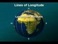 Smart Boating Series Basic Navigation N8982DVD
 Quick and easy guide to understanding basic compass terms - www.coastalsafety.com
 Navigation - Tides Problem Explained
 Ep 3: Collision Regulations: Lights and Dayshapes
 IALA Cardinal