China/(Karakoram Highway) Pamir&Kaşgar´lı Mahmut Part 11
Welcome to my travelchannel.On my channel you can find almost 1000 films of more than 70 countries. See the playlist on my youtube channel.Enjoy!
https://www.youtube.com/user/nurettinodunya/playlists
Karakoram Highway The southern route:
The Chinese Section of the Karakoram Highway follows the north-south Sarykol ('Yellow Lake') valley just west of the Tarim Basin, which is barely visible in the satellite image at left. The road from Kashgar goes southwest about 80 km and then turns west to enter the Gez (Ghez) River canyon between Chakragil mountain on the north and Kongur mountain on the south. From the Gez canyon the population becomes Kirgiz. Having climbed up to the valley, the road turns south past Kongur, Karakul Lake and Muztagh Ata on the east. Below Muztagh Ata a new road goes west over the Kulma Pass to join the Pamir Highway in Gorno-Badakhshan, Tajikistan. The main road continues over a low pass (where the population becomes Tajik) and descends to Tashkurgan. Further south a valley and jeep track leads west towards the Wakhjir Pass to the Wakhan Corridor. Next the road turns west to a checkpost and small settlement at Pirali, and then the Khunjerab Pass, beyond which is Pakistan, the Khunjerab River and Hunza.
The southern route was mainly a single route running from China, through the Karakoram, where it persists to modern times as the international paved road connecting Pakistan and China as the Karakoram Highway. It then set off westwards, but with southward spurs enabling the journey to be completed by sea from various points. Crossing the high mountains, it passed through northern Pakistan, over the Hindu Kush mountains, and into Afghanistan, rejoining the northern route near Merv. Kaynak:Vikipedia
Видео China/(Karakoram Highway) Pamir&Kaşgar´lı Mahmut Part 11 канала Nurettin Yilmaz
Показать
Комментарии отсутствуют
Информация о видео
Другие видео канала
 The Karakoram Highway - from China to Pakistan
 Karakoram Highway in HD! Adventure of a Lifetime from Kashgar (China) to Pakistan
 China/Kasghar/Turpan/(Silkroad 2002) Part 7
 Kashgar's NEW Old City | Charms & Controversy Surrounding Rebuilt History in Xinjiang, China
 Kyrgyz of the Wakhan - Life in the Afghan Pamir Mountains - CDI Project
 China/Peking to (Urumqi-Turpan-Kashgar) 2002 Part 6
 Wakhan Corridor Trek, Afghanistan 2013
 Northern Pakistan, Kalash People
 Chine - Kashgar
 The chinese silk road (From Kashgar to Beijing)
 Christian and Muslim Villages of Azerbaijan
 #Chine Vidéo du #grand #bazar de #Kashgar
 Uyghur Halal Breakfast in Kashgar
 Silk Road Series:Kashgar in Xinjiang
 La strada sul Tetto del Mondo - Karakorum Highway
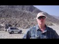 Driving the Karakoram Highway
 Tour To Khunjerab Pass , Pakistan-China Border , Gilgit-Baltistan , Pakistan
 Kashgar au Xingjiang chinois, son gigantesque marché et ses souks.qt
 China/Kashgar-Kasgar-Uyghur (Sunday Cattle Market /2002) Part 10
 Tajikistan Right through the Turkestan&Zerafshan Mountains to Khujand (II) Part 17