- Популярные видео
- Авто
- Видео-блоги
- ДТП, аварии
- Для маленьких
- Еда, напитки
- Животные
- Закон и право
- Знаменитости
- Игры
- Искусство
- Комедии
- Красота, мода
- Кулинария, рецепты
- Люди
- Мото
- Музыка
- Мультфильмы
- Наука, технологии
- Новости
- Образование
- Политика
- Праздники
- Приколы
- Природа
- Происшествия
- Путешествия
- Развлечения
- Ржач
- Семья
- Сериалы
- Спорт
- Стиль жизни
- ТВ передачи
- Танцы
- Технологии
- Товары
- Ужасы
- Фильмы
- Шоу-бизнес
- Юмор
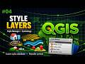
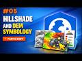
How to Style Elevation Models + Hillshade in QGIS Fast & Easy
🌄 Learn how to style elevation models (DTM/DEM) and create a clean hillshade in QGIS — fast and easy.
In this tutorial, you’ll see how to adjust Min/Max values, fix interpolation issues, apply pseudocolor ramps, highlight water areas, and blend your hillshade for a more realistic and professional result.
🔎 What you’ll learn:
• Singleband gray vs pseudocolor
• Fixing negative elevation values
• Using cumulative count cut
• Applying elevation color ramps
• Highlighting sea level (≤ 0)
• Creating a hillshade
• Blending hillshade + DTM with Multiply mode
Perfect for anyone who wants cleaner, clearer and more professional elevation maps in QGIS.
#QGIS 🌍#GIS 🗺️#ElevationModel ⛰️#Hillshade 🌄#DTM #DEM 📡#Geospatial 🔎#Mapping 🧭#QGISTutorial 🎥#GISWorkflows ⚙️#TerrainAnalysis 🏔️
Music track: Soaked by Pufino: https://freetouse.com/music Royalty Free Music (Free Download)
Видео How to Style Elevation Models + Hillshade in QGIS Fast & Easy канала Delta Base Core
Комментарии отсутствуют
Информация о видео
22 мая 2026 г. 16:54:48
00:03:14
Другие видео канала