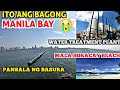
Manila Bay, Tourist spot na!! YAHOO!! Grabe ang saya! Vlog tour 2019, PHILIPPINES
Featured TODAY!! Manila Bay, CCP complex, Harbor Square, Drive tour to Mall of Asia and entertainment City ( City of Dreams, Solaire Hotel & Casino Resort and Okada Manila ) Watch til end..
Thanks for watching! I hope you enjoyed todays video...If your new SUBSCRIBE to keep updated..
For more videos go here http://bit.ly/dadakoo
Manila Bay is a natural harbour which serves the Port of Manila (on Luzon), in the Philippines. Strategically located around the capital city of the Philippines, Manila Bay facilitated commerce and trade between the Philippines and its neighbouring countries,[1] becoming the gateway for socio-economic development even prior to Spanish occupation. With an area of 1,994 km2 (769.9 sq mi), and a coastline of 190 km (118.1 mi), Manila Bay is situated in the western part of Luzon and is bounded by Cavite and Metro Manila on the east, Bulacan and Pampanga on the north, and Bataan on the west and northwest.[2] Manila Bay drains approximately 17,000 km2 (6,563.7 sq mi) of watershed area, with the Pampanga River contributing about 49% of the freshwater influx. With an average depth of 17 m (55.8 ft), it is estimated to have a total volume of 28.9 billion cubic metres (28.9 cubic km). Entrance to the bay is 19 km (11.8 mi) wide and expands to a width of 48 km (29.8 mi). However, width of the bay varies from 22 km (13.7 mi) at its mouth and expanding to 60 km (37.3 mi) at its widest point.[2]
The islands of Corregidor and Caballo divides the entrance into two channels,[2] about 2 mi (3.2 km) towards the North and 6.5 mi (10.5 km) wide on the South side. Mariveles, in the province of Bataan, is an anchorage just inside the northern entrance and Sangley Point is the former location of Cavite Naval Base. On either side of the bay are volcanic peaks topped with tropical foliage: 40 km to the north is the Bataan Peninsula and to the south is the province of Cavite.
Across the entrance to Manila Bay are several islands, the largest of which is Corregidor, located 3 kilometres from Bataan and, along with the island of Caballo, separates the mouth of the bay into the North and South Channels. In the south channel is El Fraile Island and outside the entrance, and to the south, is Carabao Island. El Fraile, a rocky island some 4 acres (1.6 ha) in area, supports the massive concrete and steel ruins of Fort Drum, an island fortress constructed by the United States Army to defend the southern entrance of the bay. To the immediate north and south are additional harbors, upon which both local and international ports are situated. Large number of ships at the North and South harbors facilitate maritime activities in the bay.[1] Being smaller of the two harbors, the North Harbor is used for inter-island shipping while the South Harbor is used for large ocean-going vessels.[2]
Thank You! See you on my next Vlog :D
Видео Manila Bay, Tourist spot na!! YAHOO!! Grabe ang saya! Vlog tour 2019, PHILIPPINES канала Dada Koo
Показать
Комментарии отсутствуют
Информация о видео
Другие видео канала
 SHOCKING TRANSFORMATION OF MANILA BAY IN 4 YEARS | YOU WILL CRY | MANILA UPDATE
 SQUATTER SA ESTERO GINIBA AT MAY FLOATING BRIDGE NA | NASAN NA SILA ? | UPDATE APRIL 2020
 Ganito na kalinis ang Maynila ngayon | Carriedo, Sta. Cruz at Liwasang Bonifacio Maluwag na!
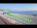 Update Manila Bay: World Class Pagkatapos Ng Rehabilitation
 Visit Clark City FreePort Zone update 2019, Angeles City, Pampanga. Joyride 2019
 I-Witness: 'Ang Huling Gubat sa Maynila,' dokumentaryo ni Howie Severino | Full Episode
 9 BIGGEST and POWERFUL DAMS in Luzon Philippines
 Mayor Isko Moreno - Plan for Manila City
 Las Pinas Update 2019. JoyRide with Dada..Manila, Philippines
 Mexico reacts to President Duterte
 PUERTO PRINCESA TOUR 2019! ANG DAMING CASHEW NUT-- PALAWAN
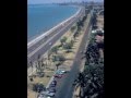 Manila 1950's
 New Manila International Airport: JICA's Information Collection Survey
 Bringing the las Piñas-Zapote River in The Philippines back to life
 CONSTRUCTION METHODS - CEBU CORDOVA LINK EXPRESSWAY (CCLEX)
 MANILA BAY, BINISITA NI DENR SEC ROY CIMATU. GAGAWING MALA-BORACAY SA GANDA. || BAKASYun NI JUAN
 The Pasig River Today
 KILLER ONE-POCKET: Scott FROST vs. Efren REYES - 2016 DERBY CITY CLASSIC ONE-POCKET DIVISION
 The New Vessel! Six 80 Meter OPVs For The Philippine Navy
 MURPHY CUBAO, SAAN BA ITO? SIGHTSEEING TOUR! 2020!