Sarajevo. Bosnia and Herzegovina. Timelapse & Hyperlapse
Welcome to Sarajevo, the gates of the East and the door of the West!
Timelapse & Edit by Kirill Neiezhmakov e-mail: hyperlapsepro@gmail.com
https://facebook.com/kirill.neiezhmakov
https://instagram.com/neiezhmakov
https://vk.com/nk_design
Vimeo: https://vimeo.com/nkdesign/sarajevo
Music: Iros Young - The Straight Story
Footage (this and many other) available for licensing in 4K
You can download it here
https://www.pond5.com/ru/collections/3199749-sarajevo
This video I shot during VIVA FILM FESTIVAL where I got 2 awards for my Rome hyperlapse https://youtu.be/y_4p6_KsqoE
Equipment:
Canon 60d, 70d, EOS R
Tokina 11-16 mm 2.8
Canon 17-55 mm 2.8
Canon 70-200 mm 4L
Canon 16-35 mm 2.8L
Canon 24-70 mm 2.8L
Manfrotto 190 carbon tripod
Software:
Adobe After Effects, Lightroom, LRTimelapse
Meaning in Persian – Turkish – Bosnian (Saray-ovasi – the plains around the palace, Sarajevo planes); Turkih (Saray-Bosna).
Half a millennium ago in Bosnia, a town nestled in the valley below mountain Trebevic, named after either a palace in the fields or the fields around the palace. Bosnian sanjak-bey Isabeg Ishakovic erected his palace on the left bank of the Miljacka River, built a bridge and founded the bazaar.
Sarajevo has always been an intersection of important roads from Eastern to Western Europe, from the Mediterranean basin to Central Europe and vice versa. “This is a city that, in the context of different historical events, has for centuries been a shelter and crossroads of worlds, with routes to Istanbul, Zagreb, Cetinje – Belgrade, Vienna – Budapest and Jerusalem.” Through history, Sarajevo become a bridge where the Orient and the West both clashed and merged.
The city itself blends in harmony with its natural surroundings. It is bordered by hills on the north, and Mt. Trebević on the south. The Sarajevo plane stretches in the west, with the Bosna River sour at the foothill of Mt. Igman. Mountains Igman, Bjelašnica, Treskavica and Jahorina are all a stone’s throw away. Numerous records in travelogues are a testament to natural beauties of Sarajevo. The city is often described as “a gem among emeralds”, “magical pearl in a green oasis”, “most beautifully positioned city”.
The city is located at an average of 550 meters above sea level, while its settlements on the slopes of the surrounding hills and mountains rise up to 700 meters above sea level.
Sarajevo and its history began to emerge in the valley of the Miljacka River. The river is 36 kilometres long, formed by the Paljanska and the Mokranjska Miljacka coming together near the village of Bulozi. It flows into the Bosna River as its right tributary, near the village of Butila. The river is most likely named after the sludge that colours the water in red during rainy seasons. There are three other rivers in the wider area of Sarajevo: Mošćanica, Željeznica and Bosnia; hence, the city has very favourable hydrological conditions and high-quality water.
Since the establishment in 1462, Sarajevo was the seat of the province within the Ottoman Empire for over four centuries, monarchy seat of the Provincial Government of Bosnia and Herzegovina during the Austro-Hungarian occupation, and since 1945 the capital of the Republic of Bosnia and Herzegovina. Since 1995, Sarajevo is the capital of Bosnia and Herzegovina.
U Bosni, u dolini ispod Trebevića, prije pola milenija, nastao je grad čije ime znači dvorac u polju ili polje oko dvorca. Bosanski sandžak – beg, Isa – beg Ishaković na lijevoj obali Miljacke podigao je taj dvorac, sagradio ćupriju i osnovao čaršiju.
Sarajevo je oduvijek bilo raskršće važnih puteva koji su išli iz istočne u zapadnu Evropu, iz mediteranskog bazena ka centralnoj Evropi i obratno. «To je grad koji je u okviru različitih historijskih zbivanja stoljećima bio utočište i raskršće svjetova, s putevima u Carigrad, Zagreb, Cetinje – Beograd, Beč – Peštu i Jeruzalem». Sarajevo je kroz istoriju postalo most na kome su se sučeljavali i spajali Orijent i Zapad.
Grad predstavlja veoma skladno ukomponovanu cjelinu sa okolnim prirodnim ambijentom. Sa sjevera ga obrubljuju brda, sa juga planina Trebević. Na zapadu se pruža Sarajevsko polje i obronci planine Igman, ispod koga izvire rijeka Bosna. U neposrednoj blizini grada nalaze se planine Igman, Bjelašnica, Treskavica i Jahorina. O prirodnim ljepotama Sarajeva ostali su brojni zapisi u putopisima. O gradu se govori kao o: «alemu među smaragdima», «čarobnom biseru u zelenoj oazi», «gradu sa najljepšim položajem».
Sarajevo i njegova istorija počinju se rađati u dolini rijeke Miljacke. Rijeka je duga 36 kilometara i nastaje spajanjem Paljanske i Mokranjske Miljacke kod sela Bulozi. Kao desna pritoka ulijeva se u rijeku Bosnu kod sela Butila. Rijeka je ime, najvjerovatnije, dobila po mulju koji u kišnim razdobljima oboji vodu u crveno. U širem području Sarajeva teku još tri rijeke; Mošćanica, Željeznica i Bosna tako da grad ima veoma povoljne hidrološke uslove i vrlo kvalitetnu vodu.
Видео Sarajevo. Bosnia and Herzegovina. Timelapse & Hyperlapse канала Kirill Neiezhmakov Timelapse & Hyperlapse
Показать
Комментарии отсутствуют
Информация о видео
25 февраля 2020 г. 10:49:23
00:02:34
Другие видео канала
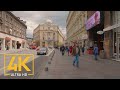 Virtual Walking Tour in 4K 60fps - SARAJEVO - The Capital of Bosnia and Herzegovina
 A Flight over Bosnia and Herzegovina - Beauty You Have Never Seen Before
 Sarajevo in 4k | Time Lapse - Aerial - Tilt- Shift
 4K Sarajevo u doba korone - COVID-19 - LOCKDOWN - Bosnia and Herzegovina - Drone Footage - Helifilm
 BBC Travel Show - The new Sarajevo (week 33)
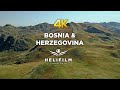 Explore the beauty of Bosnia and Herzegovina - Helifilm - Drone Footage
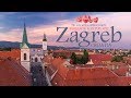 Zagreb - The city with a million hearts. Timelapse & Hyperlapse
 A Gift from Rome. Timelapse & Hyperlapse. Italy. Vatican
 Prague
 Sarajevo iz zraka - Dron.ba za N1
 White nights in Saint Petersburg. Timelapse & Hyperlapse. Белые ночи в Санкт-Петербурге
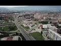 Septembarski let po Sarajevu - Novi Grad
 Bosnia & Herzegovina - Land of the forgotten beauty
 4K CABVIEW Capljina - Sarajevo - 99 tunnels and 65 bridges - The Neretva River Canyon
 Hang out in Lima | Peru Hyperlapse
 Москва Timelapse in Motion (Hyperlapse by Кирилл Неежмаков)
 【4K】Drone Footage | The Beauty of Bosnia and Herzegovina ..:: Bird's View | Aerial Video
 Najljepše skrivene ljepote Bosne i Hercegovine - I dio - Dron.ba za N1
 SARAJEVO in 2020 - Fascinating in so many ways...