A Complete Beginner's Guide to ArcGIS Pro: Part 1
Hi everyone. Hope you are doing fine. Welcome to GIS & RS Solution. Today’s tutorial about ArcGIS Pro. I have already uploaded a video on how you can download and install. Today I’m gonna show how you will prepare a complete Map using ArcGIS pro. In this video, you will learn how to add shapefile, Extract shapefile as per the AOI/study area, also how you can cut a raster file according to your study area, Layout preparation techniques, change symbols, Add title and legend modification techniques, grid, scale and so on. I hope this video will be a complete beginner's guide to ArcGIS pro.
The length of the video is about 23 minutes. So I have divided it into two-part. The next part will be uploaded on Friday. Till then stay safe and happy. Thank you.
GIS Shapefile of any country: https://www.youtube.com/watch?v=gJZ5FWG6jHM
Download DEM data: https://www.youtube.com/watch?v=DSSQ0HrT9bg&t=38s
#arcgispro #study_area_map #maplayout #arcgisprotutorial #arcgis #arcgisproforbeginners
Видео A Complete Beginner's Guide to ArcGIS Pro: Part 1 канала GIS & RS Solution
Показать
Комментарии отсутствуют
Информация о видео
Другие видео канала
 Estimation of any Land Classes from LULC Map Based on the Gradient Direction & Distances | Part 2
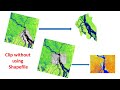 Clipping/Extracting Raster Data without Using any Shapefile in ArcGIS
 Identify Affected Structures for a Proposed Road Project Using ArcGIS
 How to Download Digital Surface Model (DSM) !! Which is best DSM or DEM?
 How to Create YouTube, Facebook, Gmail Shortcut on Desktop
 Mapping Ecosystem Service Value (ESV) using ArcGIS
 Extract Elevation Values from DEM
 Risk Assessment (Fire, Explosion, Flammable, Toxic Gas dispersion) of an Industry Using ALOHA
 Download Tidal Data for any Location
 Estimation of Urban Areas Based on the Gradient Direction & Distances & Urban sprawl mapping |Part 1
 A Complete Tutorial on Making Wind Rose Diagram (Software Download, Installation & Diagram Creation)
 How to Remove No Data/Black Background from Raster Images
 Adding Google Earth Satellite Image/Google Maps and Work Faster in ArcGIS
 Area, Perimeter, Calculate Geometry Tool Disabled Problem Solved in ArcGIS
 Download Hourly Precipitation, Temp, Cloud Cover, Humidity, Wind speed, direction from 1940-Present
 GIS Day 2023
 Download GIS & Remote Sensing Book for Free
 How to Draw Automatic Duplicate Line in ArcGIS
 Wind Rose Diagram Using AERMET VIEW
 Download Earthquake Data of any location for free
 GIS Shapefile of any Country