Glacial Processes and Landforms
A glacier is a moving river of ice on land. In this video Geography teacher Darron Gedge discusses how glaciers are formed and how the processes of glacial erosion, transportation and deposition create various types of land forms. The main glacial erosion processes are plucking, abrasion, and freeze-thaw. Landforms made by glaciers include moraines, drumlins, pyramid peaks, cirques, ribbon lakes, tarns, hanging valleys, aretes, fiords and U shaped valleys. This video was manly filmed in the South Island of New Zealand.
Satellite images in the video are provided by Google and its map data providers.
Satellite images of the Greenland Ice Sheets, Greenland medial moraines, and Milford Sound: 2020 Maxar Technologies
Satellite images of Norway and its fiords: Image IBCAO, Image Landsat/ Copernicus, Data SIO, NOAA, US Navy, NGA, GEBCO, Image US Geological Survey
Satellite images of the Antarctic Ice sheets: Image US Geological Survey, Data SIO, NOAA, US Navy, NGA, GEBCO, Data LDEO Columbia, NSF, NOAA, Image Landsat/ Copernicus
Satellite images of Canada's west coast: Data SIO, NOAA, US Navy, NGA, GEBCO, Data LDEO Columbia, NSF, NOAA, Image Landsat/ Copernicus, Data LDEO Columbia, NSF, NOAA
Satellite image of Fiordland: Data SIO, NOAA, US Navy, NGA, GEBCO, Image Landsat/ Copernicus, Data LDEO Columbia, NSF, NOAA
Видео Glacial Processes and Landforms канала Darron Gedge's Geography Channel
Показать
Комментарии отсутствуют
Информация о видео
27 ноября 2020 г. 16:29:10
00:14:14
Другие видео канала
 Glacial Landforms |Erosional and Depositional Features by Glacier| Geomorphology|Dr. Krishnanand
 What are glaciers, and how do they impact the land?
 BBC Geography - Glaciers
 What types of Landforms are made by Rivers?
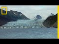 Climate 101: Glaciers | National Geographic
 Glacial erosion.mov
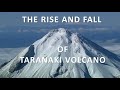 Erosion and Sedimentation of Taranaki Volcano
 Longs Pass Serpentinite
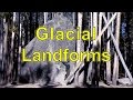 Glacial Landforms
 Rockhounding glacial till, a trip to a local stream, #4
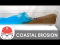 How Coastal Erosion Works
 5 Monster Glacier Collapse Caught On Camera
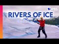 How Do Glaciers Move?
 Internal Land Forming Processes
 Alpine Glacier Basics
 How Do Glaciers Move? TIMELAPSE! | Earth Lab
 How do glaciers shape the landscape? Animation from geog.1 Kerboodle.
 The Last Deglaciation in Europe : Every year
 Identifying Minerals -- Earth Rocks!