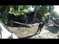
Biker vs Landowner #2
A civil altercation with a landowner at Little Shurdington near Cheltenham.
This road has been signed on the ground as a bridleway for a number of years despite being marked as an unclassified road (ORPA) on the various OS maps that I have access to, along with the rights of way map on the Gloucestershire County Council website.
A conversation on 08.10.13 with KP from Gloucestershire County Council's rights of way department confirmed that:
1. The right of way is incorrectly signed as a bridleway.
2. The right of way is a mixture of class 5 & 6 highway.
KP explained that class 5 highway is maintained to a basic standard for use by wheeled vehicles, and could be found at either end of the right of way.
Class 6 highway compromises the middle section of the right of way and crosses open farmland on a semi-defined track. KP explained that this was usually maintained to pedestrian standards, unmettled (unpaved) and is usually 'unsuitable for wheeled vehicles'.
This particular stretch of class 6 highway is too narrow for anything other than pedestrian, horse, cycle and motorcycle. It connects Little Shurdington to Cold Slad.
The landowner had blocked our path and we were both ready to turn back when an unexpected change of heart allowed us to proceed.
How do you think I handled the confrontation? Please be respectful to the landowner (you're welcome to speak your mind towards me!).
NGR: SO924168.
Road numbers: 51128 and 60119.
Gloucestershire CC RoW map:
https://gloucestershire.firmstep.com/default.aspx/RenderForm/?F.Name=B75apJt4Qgo&HideToolbar=1
Видео Biker vs Landowner #2 канала Wiltshire Byways
Показать
Комментарии отсутствуют
Информация о видео
Другие видео канала
 Biker vs Landowner
 Man with a shotgun and a Green lane, Laning, byway confrontation at 2:33 seconds
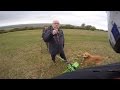 dirt bike vs angry people
 The Grim Reality of Motorcycle Trail Riding in the UK
 BACK TO CAMPING | 2 Day 4x4 Wild Camping Trip | Lakes & Pennines | Green Lanes UK | Roof Top Tents |
 Biker vs Landowner #5
 BIKER VS LANDOWNER
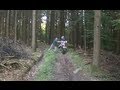 EXS- Angry forester HITS and PUSHES driver! no music!
 Biker vs Landowner #3
 4WD Greenlaning for beginners UK
 Angry Landowner at Chelscombe Farm near Bath (1996)
 GORGE WALKING AND IRATE LANDOWNER ON QUAD
 Biker vs Dog Walker
 po-faced walker argument trail riding
 Green Lane Route from Nant-y-Moch
 Coast 2 Coast trail ride
 Quarry Road byway near godstone
 Wire on the Byway
 Biker vs Landowner #4
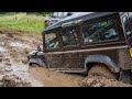 STUCK IN DEEP MUD -Morpeth - Northumberland greenlaning - Ep6