A real time drive around the coastline of the United Kingdom - Day 7
Join us as we make our 5,108 mile real time drive by road, around the coastline of the United Kingdom. Full disclosure – we haven’t completed Northern Ireland yet but when we do we’ll add that to the total mileage.
The intention was to take the longest possible route, driving as close to the coast as possible and never using a Motorway! We tried to see as much of our coastline as we could.
The journey had some dark and drizzly days to begin with, but many were sunny and truly beautiful, especially the west coast of Scotland.
The journey took about 30 full days to complete. Our campervan ‘Minty’ served us very well; he is a 2005 Timberland Independence with a 2.8L Fiat Ducato manual gearbox.
In order to find the route closest to the coast we needed to use Google Maps, hence the constant verbal navigation by whomever wasn’t driving. Oh, and sorry about Bev’s occasional swearing!
On days 1 and 2 we learned that even in UK conditions the GoPro Hero 9 could not handle 4k and overheated a number of times, hence the occasional editing fades and the noise produced by the vents trying to cool the camera. We resolved this by changing to 1080p and had no further overheating and therefore very few edits.
I gave lots of thought to producing silent videos or to leave all voice and background noise in and unedited. If you don’t like our noise, please turn us down!
We had lockdowns, breakdowns, flat tyres, closed roads, golf courses, the occasional wrong turn and all manner of friendly disagreements but, overall, we loved the adventure.
It’s a long ride, so buckle up!!
Jon, Bev and Charlie
----------------------------------------------------------------------------------------------------------------------------------------------------------------
Oscardewyldde has kindly assisted by making time and location markers for easier navigation throughout this video:
Day 7: Llanfairfechan, Conwy, Wales to Hesketh Bank, Lancashire, England. 117 miles again!
Weather: Good day, high overcast.
0:00:55 Departs from Llanfairfechan area; 4 miles to Conwy
0:02:06 Penmaen-Bach 245m and quarry and Tunnels sign
0:06:20 Conwy sign
0:07:40 Town walls
0:09:04 Castle and Guild Hall (RHS)
0:09:25 Conwy Suspension bridge over the River Conwy estuary
0:10:02 Llandudno Junction area
0:12:07 Deganwy sign
0:18:21 Llandudno West shore beach area
0:24:39 North Shore beach view
0:28:17 Little Ormes Head and Craigside area
0:30:08 Bae Penrhyn/Penrhyn Bay sign
0:32:46 Llandrillo yn Rhos area
0:36:26 Colwyn Bay area
0:45:19 Llanddulas sign
0:46:40 Gwyrch Castle
0:48:54 Abergele sign
0:53:10 Pensarn area
0:54:23 Belgrano area
0:54:49 Towyn sign
0:56:05 Towyn sign (second)
0:58:27 Kimmel Bay area
1:00:33 Bridge over River Clywd
1:00:54 Rhyl sign
1:09:52 Prestatyn sign
1:20:30 Lower and Upper Gronant area
1:23:32 Tan Lan sign
1:26:27 Ffynnongroyw and Peny-ffordd area
1:27:38 Mostyn sign
1:30:39 Llanerch-Y-Mor sign
1:32:57 Greenfield/Maes Glas sign
1:42:07 Y Fflint/Flint sign
1:45:58 Oakenholt sign
1:49:07 Connahs Quay Power Station
1:49:41 Flintshire bridge over River Dee
1:52:45 Shotwick Solar Park and Deeside Industrial Park
1:55:45 Wales/England border crossed but no sign.
1:56:50 Shotwick area
2:04:30 Burton area
2:11:14 Ness sign
2:13:26 Neston sign
2:16:57 Parkgate sign
2:17:29 View of River Dee estuary
2:23:17 Wirral sign Gayton area
2:24:12 Heswall sign
2:31:42 Thurstaston area
2:35:20 Caldy area
2:38:41 West Kirby area
2:45:39 Hoylake area
2:46:32 View of East Hoyle Bank
2:50:00 Great Meols area
2:55:35 Moreton area
3:00:22 Leasowe sign
3:02:45 Wallasey area
3:07:48 New Brighton sign and Promenade
3:13:24 Liscard sign
3:20:28 Tollway for Wallasey tunnel
3:24:40 Exit tunnel in the Vauxhall area (Liverpool)
3:30:05 Sandhills area
3:32:00 Bootle area
3:36:00 Seaforth area
3:37:42 Crosby area
3:38:43 Crosby and Waterloo sign
3:42:17 New Brighton area
3:42:50 Brighton-le-Sands sign
3:44:29 Blundellsands area
3:51:17 Little Crosby sign
3:59:58 Formby area
4:04:45 Woodlands area
4:07:20 Freshfields area
4:12:07 RAF Woodvale airfield
4:13:20 Southport area (Ainsdale)
4:17:50 Ainsdale village sign
4:27:13 Royal Birkdale Golf Club sign
4:27:25 Birkdale area
4:32:25 Southport area
4:34:00 New Pleasureland, Southport
4:34:48 Pier
4:39:32 Crossens marsh area
4:41:52 Crossens area
4:44:27 Banks sign
4:50:23 Hesketh Bank sign.
Source: OpenStreetMap and Google Maps
Видео A real time drive around the coastline of the United Kingdom - Day 7 канала Geovanni
Показать
Комментарии отсутствуют
Информация о видео
Другие видео канала
 A real time drive around the coastline of the United Kingdom - Day 23
 A real time drive around the coastline of the United Kingdom - Day 14
 A real time drive around the coastline of the United Kingdom - Day 21
 A real time drive around the coastline of the United Kingdom - Day 9
 A real time drive around the coastline of the United Kingdom - Day 30
 A real time drive around the coastline of the United Kingdom - Day 12
 A real time drive around the coastline of the United Kingdom - Day 20
 A real time drive around the coastline of the United Kingdom - Day 22
 A real time drive around the coastline of the United Kingdom - Day 17
 A real time drive around the coastline of the United Kingdom - Day 1
 A real time drive around the coastline of the United Kingdom - Day 13
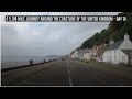 A real time drive around the coastline of the United Kingdom - Day 19
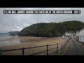 A real time drive around the coastline of the United Kingdom - Day 5
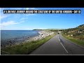 A real time drive around the coastline of the United Kingdom - Day 10
 A real time drive around the coastline of the United Kingdom - Day 2
 Calais to Dortmund real time road trip
 A real time drive around the coastline of the United Kingdom - Day 4
 A real time drive around the coastline of the United Kingdom - Day 3
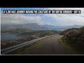 A real time drive around the coastline of the United Kingdom - Day 16
 A real time drive around the coastline of the United Kingdom - Day 8