- Популярные видео
- Авто
- Видео-блоги
- ДТП, аварии
- Для маленьких
- Еда, напитки
- Животные
- Закон и право
- Знаменитости
- Игры
- Искусство
- Комедии
- Красота, мода
- Кулинария, рецепты
- Люди
- Мото
- Музыка
- Мультфильмы
- Наука, технологии
- Новости
- Образование
- Политика
- Праздники
- Приколы
- Природа
- Происшествия
- Путешествия
- Развлечения
- Ржач
- Семья
- Сериалы
- Спорт
- Стиль жизни
- ТВ передачи
- Танцы
- Технологии
- Товары
- Ужасы
- Фильмы
- Шоу-бизнес
- Юмор
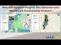
Healthcare Survey Mapping Made Easy | Collect GPS, Photos & Field Data with MAPOG #mapog #viral #gis
Managing healthcare facility surveys across multiple regions can be difficult when data is scattered across spreadsheets, photos, and disconnected systems.
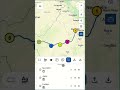
With MAPOG, healthcare teams can collect, map, manage, and analyse healthcare survey data in real time—all from one powerful GIS-based platform.
In this video, you’ll learn how to create and manage healthcare surveys using MAPOG, assign field teams, capture GPS-based facility data, upload photos & videos, review submissions, and visualise insights directly on interactive maps.
🚀 What You’ll Learn:
✔️ How to create a healthcare survey project
✔️ Build custom healthcare location templates
✔️ Add facility attributes like services, hours, media files & operational details
✔️ Create structured survey questionnaires
✔️ Upload healthcare facility locations using CSV/Excel
✔️ Assign contributors and survey regions
✔️ Collect field data using MAPOG Contributor App
✔️ Capture GPS locations with photos & videos
✔️ Track survey progress in real time
✔️ Review and approve submissions
✔️ Export healthcare survey reports
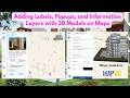
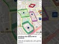
✔️ Visualise healthcare data with colour-coded map layers
✔️ Perform better spatial healthcare analysis
🧠 Why This Matters
Traditional healthcare surveys often lead to:
• Delayed reporting
• Missing facility data
• Inaccurate field records
• Poor regional visibility
With MAPOG, you get:
▸ Real-time GPS-based healthcare mapping
▸ Accurate field verification with photos & videos
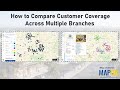
▸ Better regional monitoring
▸ Faster analysis & decision-making
▸ Centralised healthcare data management
🎯 Who Should Watch
• Healthcare Organisations
• Hospital Administrators
• GIS Professionals
• Survey Teams
• Public Health Departments
• Field Monitoring Teams
• Health Infrastructure Managers
🌐 Get Started
👉 Explore more : https://story.mapog.com/?code=aff_c60cbf834f9e/?utm_source=Youtube&utm_medium=YoutubeVideo&utm_camp…
📩 support@mapog.com
#mapog #healthcaremapping #healthcaregis #gis #surveymapping #healthcaredata #fieldsurvey #gpsmapping #digitalhealthcare #geospatial #datacollection #healthcareanalytics #healthcaretechnology #publichealth #facilitymapping #medicalinfrastructure #smartmapping #locationintelligence #datavisualization #mappingtechnology #geospatialdata #gissoftware #healthcareinnovation #healthtech #fielddatacollection #surveytools #digitalmapping #healthcaremanagement #spatialanalysis #healthcarefacilities
Видео Healthcare Survey Mapping Made Easy | Collect GPS, Photos & Field Data with MAPOG #mapog #viral #gis канала MAPOG
With MAPOG, healthcare teams can collect, map, manage, and analyse healthcare survey data in real time—all from one powerful GIS-based platform.
In this video, you’ll learn how to create and manage healthcare surveys using MAPOG, assign field teams, capture GPS-based facility data, upload photos & videos, review submissions, and visualise insights directly on interactive maps.
🚀 What You’ll Learn:
✔️ How to create a healthcare survey project
✔️ Build custom healthcare location templates
✔️ Add facility attributes like services, hours, media files & operational details
✔️ Create structured survey questionnaires
✔️ Upload healthcare facility locations using CSV/Excel
✔️ Assign contributors and survey regions
✔️ Collect field data using MAPOG Contributor App
✔️ Capture GPS locations with photos & videos
✔️ Track survey progress in real time
✔️ Review and approve submissions
✔️ Export healthcare survey reports
✔️ Visualise healthcare data with colour-coded map layers
✔️ Perform better spatial healthcare analysis
🧠 Why This Matters
Traditional healthcare surveys often lead to:
• Delayed reporting
• Missing facility data
• Inaccurate field records
• Poor regional visibility
With MAPOG, you get:
▸ Real-time GPS-based healthcare mapping
▸ Accurate field verification with photos & videos
▸ Better regional monitoring
▸ Faster analysis & decision-making
▸ Centralised healthcare data management
🎯 Who Should Watch
• Healthcare Organisations
• Hospital Administrators
• GIS Professionals
• Survey Teams
• Public Health Departments
• Field Monitoring Teams
• Health Infrastructure Managers
🌐 Get Started
👉 Explore more : https://story.mapog.com/?code=aff_c60cbf834f9e/?utm_source=Youtube&utm_medium=YoutubeVideo&utm_camp…
📩 support@mapog.com
#mapog #healthcaremapping #healthcaregis #gis #surveymapping #healthcaredata #fieldsurvey #gpsmapping #digitalhealthcare #geospatial #datacollection #healthcareanalytics #healthcaretechnology #publichealth #facilitymapping #medicalinfrastructure #smartmapping #locationintelligence #datavisualization #mappingtechnology #geospatialdata #gissoftware #healthcareinnovation #healthtech #fielddatacollection #surveytools #digitalmapping #healthcaremanagement #spatialanalysis #healthcarefacilities
Видео Healthcare Survey Mapping Made Easy | Collect GPS, Photos & Field Data with MAPOG #mapog #viral #gis канала MAPOG
Комментарии отсутствуют
Информация о видео
11 мая 2026 г. 10:48:18
00:04:27
Другие видео канала