Country Size Comparison
A continuous zoom out shot of all countries according to area with a grid background. Full zoom preview towards the end.
Note:
1) Countries are classified according to their surface area size from Google Maps. Data taken from CIA World Factbook 2014
2) Only internationally UN recognized countries listed. If the CIA book doesn't list it, this video won't either. Sorry for any inconvenience caused.
3) Some maps sizes may appear different due to the curvature of the Earth.
4) Apologies for any lag.
PS: The map of Palestine is wrong, it should look like this : https://commons.wikimedia.org/wiki/File:Flag_map_of_the_Palestinian_territories.svg . Likewise for Asia. There are also some mistake in the area of Oceania.
Music used:
Bama Country Kevin MacLeod (incompetech.com)
Licensed under Creative Commons: By Attribution 3.0 License
http://creativecommons.org/licenses/by/3.0/
Flag map used:
https://commons.wikimedia.org/wiki/Commons:WikiProject_Flag-map (Most are either under Public Domain or Licensed under Creative Commons: By Attribution 3.0 License)
Видео Country Size Comparison канала Reigarw Comparisons
Показать
Комментарии отсутствуют
Информация о видео
Другие видео канала
 Countries Of The World With Flags/Countries Of The World Song
 Beyond Infinity Number Comparison
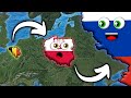 Country Size Comparison and Universe Size Comparison
 Scratch Off World Map with Flags Poster - GoGoUnique
 EVOLUTION of WORLD'S TALLEST BUILDING: Size Comparison (1901-2022)
 Animal Size Comparison 3D
 Universe Size Comparison 3D
 How the World Map Looks Wildly Different Than You Think
 Tour the World - Official Music Video
 Polandball 19: History of Europe: 1000 AD-2020
 Country SIZE COMPARISON ALL 195 Countrys | LeeZY Comparisons
 Richest Country Comparison
 Asia/Continent of Asia/Asia Geography
 Transforming Transnational Flags
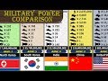 Military Size Comparison
 Universe Size Comparison 2020
 History of the Earth
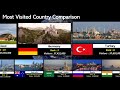 Tourism Popularity Comparison
 National Animals of Countries | Flags and Countries name With National Animal
 Human Body for Kids and Human Body Size Comparison