A Virtual Drive Up The Superior to Miami, Arizona Highway -- December 15th, 2021
Constructed between 1919 and 1922 and in use until 1952, this original and still intact 2.5-mile section of the Superior-Miami Highway is now known as the Legends Of Superior Trail (LOST). With completion of the 1949-built Queen Creek high arch bridge and the 1952-bored Queen Creek Tunnel, the safer and quicker US-60 was able to bypass this dangerous section of the Superior-Miami Highway with its narrow road cut into cliff-faces and rock walls, very tight curves, and steep grades.
With the idea to try and recreate a "drive" up the long abandoned Superior-Miami Highway, I set my GoPro Hero 9 to TimeWarp mode and started up the now 100-year-old highway. Starting at the very edge of Magma Road in Superior, we start up what many refer to as Devil's Canyon. With Queen Creek to the left and the modern US-60 high to the right, we head east into the canyon. After 2 left turns we cross a concrete arch bridge across Queen Creek and continue a short way and see the 1949-built Queen Creek Bridge high above carrying the US-60 up the canyon. With Queen Creek now on the right for the remainder of the journey, the canyon widens out for a bit as we now again are heading east. Shortly we come to a huge modern water tank where the Superior-Miami Highway makes a quick 180° hairpin-turn and quickly begins to gain altitude. The next half-mile is no joke steep for a paved road! With several sharp switchback curves -- in short order, Queen Creek is now a few-hundred feet below us. The road now is perched on a man-made ledge high on the cliff-face as we are now dodging many large rocks which have fallen onto the road in the last 70+ years. A few more turns and the very tight Claypool Tunnel now comes into view. We quickly are through the solid rock bore and emerge onto an almost 90° left turn with a sheer 200-foot drop to the creek below. This is the last section of the abandoned 100-year-old highway through Devil's Canyon and is perched on a ledge cut into the cliff walls. Shortly we pass through a gate and are now at the east end of the 1952 Queen Creek Tunnel and are standing next to the busy US-60 which continues up the Devil's Canyon on the same shelf cut for the Superior-Miami Highway 100-years ago.
The US-60 now carries all of the traffic from the Phoenix metro area east through Superior and up into Devil's Canyon (Queen Creek Canyon) and on to Miami, Claypool, and Globe -- also known as Arizona's Copper Corridor.
According to the walking app on my phone, the elevation gain on this 2.5-mile section of the abandoned highway is 666-feet. Somehow appropriate for a location known as Devil's Canyon.
Thank you for taking this journey and for reading all of this if you've made it this far. 😊
The song is Cross The Road by Silent Partner and is available in the YouTube Audio Library.
Видео A Virtual Drive Up The Superior to Miami, Arizona Highway -- December 15th, 2021 канала eSPeeScotty
Показать
Комментарии отсутствуют
Информация о видео
Другие видео канала
 1964 Peterbilt 351Transfer-Dump Truck At Green's RV World Yuma, Arizona -- March 25th, 2023
 Gold Canyon, Arizona Sunset Time Lapse With A Little Rain -- March 10th, 2021
 Gold Canyon, Arizona Sunset -- Time Lapse January 22nd, 2021
 The Sun, the Moon, and Venus Passing Over Gold Canyon, Arizona, Time Laspe -- October 8th, 2021
 Gold Canyon, Arizona Sunset Time Lapse With A Peek-A-Boo Moon -- March 5th, 2021
 Clouds, Contrails, And A Sunset With A Moon Chaser Time Lapse -- February 14th, 2021
 Truckin' For Kids 2021 Sampler Platter
 1953 John Deere 60 Pulling The Sled At Apache Junction, Arizona On 3-14-20
 Beautiful 2-Axle Peterbilt 359 With Brand New Rogue Belly Dump Doubles At Truckin' For Kids 2023
 Nice-Looking Old Mack B-61 At The 2023 Desert Diesel Nationals Chandler, Arizona -- April 15th, 2023
 A Full Moon Rises Over A Cactus Flower Blooming In The Night
 Trucks Leaving Truckin' For Kids 2021 -- Part 3
 Gold Canyon, Arizona Sunset Time Lapse -- February 25th, 2021
 Gold Canyon, Arizona Sunset Time-Lapse -- November 24th, 2021
 Piazza Trucking Western Star W4900SB "Rockstar" And 9-Axle Cozad Trailer "8 Ball" At TFK 2023
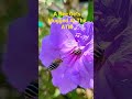 A Bee Gets Mugged At The ATM
 Jake C. DeWitt's 1953 Mack LT Seen At Mike Green's ATHS Open House In Yuma, Arizona -- 3-25-23
 Gold Canyon, Arizona Welcomes In 2023
 John & Marilyn Stewart's 1999 International Cab-Over Arriving At Truckin' For Kids 2021
 Sosa Trucking Kenworth W900L's And V-Bros. Racing W900A At Truckin' For Kds 2022
 A Winters Day At Canyon Lake, Arizona -- Time Lapse January 17th, 2021