QGIS User 0036 - QGIS and Blender
How to create images that can be used in Blender to generate topographic 3D terrain models.
This was a bit problematic to record. When rendering with Cycles in Blender it takes up a lot of resources that conflict with the screen recording. There will be some frozen video frames in this video when that happens (sorry).
https://qgis.org
https://blender.org
Видео QGIS User 0036 - QGIS and Blender канала Klas Karlsson
Показать
Комментарии отсутствуют
Информация о видео
Другие видео канала

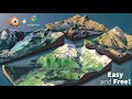 How to Create 3D Terrain with Google Maps and Blender!
 QGIS User 0025 - Complex Labels
 Blender Secrets - Blender GIS (Extra Bonus Tutorial)
 QGIS 3 for Absolute Beginners
 QGIS User 0033 - Creating Point Clouds
 Creating Textured 3D Terrains with QGIS and Blender
 Terrain Raster to 3D Model using QGIS and Blender in less than 10 Minutes
 Blender GIS - introduction and complete workflow
 Apartment Building in Blender - 3D Modeling Timelapse
 How to Create Real 3D Terrain in Blender | No Plugins | PremiumBeat.com
 QGIS User 0026 - Satellite Imagery to GPKG
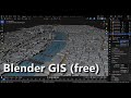 Blender GIS
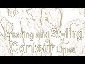 QGIS User 0027 - Styling Contour Lines
 Blender Landscapes Tutorial 1
 Blender for Beginners: Easy Froggy!
 Create hillshade 3D views of scanned topographical maps in QGIS
 Blender 3.0 - Learn how to set and use the New Asset Browser
 3D Terrain Modelling with QGIS and Blender
 QGIS 3D Modelling