- Популярные видео
- Авто
- Видео-блоги
- ДТП, аварии
- Для маленьких
- Еда, напитки
- Животные
- Закон и право
- Знаменитости
- Игры
- Искусство
- Комедии
- Красота, мода
- Кулинария, рецепты
- Люди
- Мото
- Музыка
- Мультфильмы
- Наука, технологии
- Новости
- Образование
- Политика
- Праздники
- Приколы
- Природа
- Происшествия
- Путешествия
- Развлечения
- Ржач
- Семья
- Сериалы
- Спорт
- Стиль жизни
- ТВ передачи
- Танцы
- Технологии
- Товары
- Ужасы
- Фильмы
- Шоу-бизнес
- Юмор
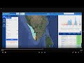
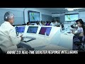
Watershed Planning using AI, Remote Sensing, ML and GIS
The healthy watershed has multifold environmental and economical benefits. This solution helps in scientific watershed planning by unifying various data and leveraging remote sensing and AI. The interactive 3d tool helps study drain. It prepares a watershed master plan with integrated e-workflow. The validation module comes with a geo intelligent mobile app, enabling field surveys. It provides an impact assessment tool to compare the watershed health over time and identify the impact of watershed conservation activities.
Видео Watershed Planning using AI, Remote Sensing, ML and GIS канала Vassarlabs
Видео Watershed Planning using AI, Remote Sensing, ML and GIS канала Vassarlabs
Комментарии отсутствуют
Информация о видео
16 ноября 2021 г. 9:43:50
00:00:29
Другие видео канала