Download Geological ,Geomorphological,soil and land use map in .shp(Shape file) of India for free
Not only these,you can even download land use and soil map(C horizon and regolith)
Bhukosh registration link: https://www.gsi.gov.in/webcenter/portal/OCBIS/pageQuickLinks/pageRegistration
Bhukosh login link: http://bhukosh.gsi.gov.in/Bhukosh/Public
Like share and subscribe this channel for more videos on GIS and Hydrological modelling
contact us for professional services here rohitcivilme@gmail.com Thank you
Видео Download Geological ,Geomorphological,soil and land use map in .shp(Shape file) of India for free канала JALAJ DARPAN
Показать
Комментарии отсутствуют
Информация о видео
Другие видео канала
 Free download Latest Landuse and Landcover (LULC) raster data for whole world from Esri landcover
 Download FAO soil shape file of the world and prepare soil texture map in ArcGIS
 How to make Soil map for any country/ For India to Process SWAT model
 Add Bhuvan thematic map layers into ArcGIS || Add WMS Layer into ArcMap
 Download Free World Geological maps!!Download India geological map in vector Format
 LULC for India data Download and create shapefile
 Download Free Topographic Map from Survey of India - Sep 2021
 How to Download Shapefile (Road, Rail, Drainage Network) from Open Street Map for your Study area
 Download Soil data and Prepare Soil Type Map in ArcGIS
 Climate Data (Temperature, Precipitation, Humidity) from 1981-2021
 Download World Geological Map's shape file data For Free
 Download Thematic Map Layer from Bhuvan || Download Geomorphology, LULC, Liniment Map from Bhuvan
 River, Basin, sub basin shapefiles for any area of the world
 Groundwater Potential zone Mapping in Arc GIS using Analytic Hierarchy Process (AHP) - Part 1
 Identification of Groundwater Potential Zone using GIS/Remote Sensing Techniques and AHP (Part-1)
 HEC-RAS tutorial:Adding Bridge and Dyke in 1D steady flow model
 Download Rainfall Data 1901-2021 (NetCDF) and Prepare Annual Rainfall Map
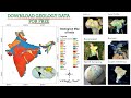 Geology Data, Shapefile for any Location
 Making a Geological Map using QGIS
 Landslide Data for whole World | Prepare Landslide Inventory Map