Download Vector Data From Open Street Map || Easy Access || @geotechstudio
If you have any confusion regarding this you can comments below.
Donot forget to like share and subscribe if you like our videos.
Link to other Videos:
DEM and LULC Data Preparation for SWAT Model :
https://youtu.be/EafZcQp-Has
Soil Map Preparation for SWAT Model :
https://youtu.be/-rClMyqiAG8
Data Preparation SWAT Model : Soil Properties Data || SWAT Simulation:
https://youtu.be/KDwXTG4_Yns
Installation of ERDAS Imagine 2015:
https://youtu.be/d3_fJWHsT-o
Mosaicing in GIS:
https://youtu.be/ea_QtTTca4M
Slope Analysis from DEM in ArcGIS:
https://youtu.be/ynaBhCwOT1w
Digitization in QGIS Using Snapping Options
https://youtu.be/HnEq6-84dTk
Georeferencing on QGIS
https://youtu.be/qkS3SBN7WUA
Hotspot Analysis Using ArcMap:
https://youtu.be/n5CkLNEQOwg
Stream Order Analysis from a Digital Elevation Model using ArcGIS 10.X
https://youtu.be/Zt5Dzp80C8k
Extraction or Digitization of Land features using Landsat 8 Data:
https://youtu.be/t0eZlvPOkXI
Calculating Land Surface Temperature using Landsat 8 images by ArcGIS:
https://youtu.be/t0eZlvPOkXI
Calculating the Criteria Weight by Multiple Criteria Decision Making :
https://youtu.be/2X9ZNOex1IQ
Interpolation:
https://youtu.be/0Rn-ojbu9uM
Thematic Mapping of COVID-19:
https://youtu.be/PgogWgiTkg0
Study Area Mapping:
https://youtu.be/wXcocGiwobE
Landuse Land Cover link:
https://youtu.be/Ci5FlJihbxs
Landslide Assessment video link:
https://youtu.be/PbqQE0DEknc
USGS data downloading tutorial video link:
https://youtu.be/9ojhH-WxFzs
Fire Risk Assessment video link:
https://youtu.be/wwccFbNFyLU
Water Delineation Tutorial link:
https://youtu.be/3wBVxfM4wmo
Georeferencing On ArcMap:
https://youtu.be/bErGQNnEi7U
Official Gmail ID: bpcreation99@gmail.com
Видео Download Vector Data From Open Street Map || Easy Access || @geotechstudio канала GeoTech Studio
Показать
Комментарии отсутствуют
Информация о видео
Другие видео канала
 Distribution Map
 Land Use,Slope and Soil definitions||HRU analysis || Part 1 || @geotechstudio
 LULC Text File Preparation || Project Setup || Watershed Delineation || SWAT || @GeoTech Studio
 Forest Resources Inventory Using Terrestrial Laser Scanner || TLS || FARO || @geotechstudio
 Extracting topographic elevation from DEM Using python ||@geotechstudio
 Download Latest ESRI 2020 Land Cover released on 24 June 2021 || @geotechstudio
 How to solve icon loss error from taskbar while installing ERDAS ?? || @geotechstudio
 Downloading Contour Data, Creating DEM, Slope, Aspect and 3D Image in QGIS || @GeoTech S
 Digital Soil Map || Soil Properties and Crop Map of Nepal || NARC Soil Map || @geotechstudio
 Equal Block Division Using Parcel Editor || Digitization Method || Second Method ||@geotechstudio
 Create DEM Using Google Earth || Calculating Elevation of (X,Y) Co-ordinate || @geotechstudio
 Stream Frequency Mapping in ArcGIS || Drainage Frequency || @geotechstudio
 Splitting Polygon Into Equal Parts Using Parcel Editor Toolbox || ArcGIS 10.2.2 || @geotechstudio
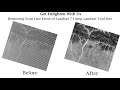 Removing Scan Line Error of Landsat 7 Using ArcGIS Landsat Tools || Landsat Tools||@geotechstudio
 A Complete Beginner's Guide for QGIS 3 || QGIS for Beginners 2020 || @geotechstudio
 Download latest Temperature and Precipitation Data of World || Get your Own Data || @geotechstudio
 An Absolute Guide for Beginners || Beginners Series For ArcGIS || Part 2 || @geotechstudio
 Download Sentinel L2A Data From Copernicus Open Acess Hub || @geotechstudio
 Absolute Guide For ArcGIS Beginners || Beginner Series For ArcGIS 2020 || Part 1 ||@geotechstudio
 Accuracy Assessment || Kappa Coefficient || Overall Accuracy || User's Accuracy || Producer Accuracy
 Equal Block Division based on Area || Google Earth || Uncut video || @geotechstudio