- Популярные видео
- Авто
- Видео-блоги
- ДТП, аварии
- Для маленьких
- Еда, напитки
- Животные
- Закон и право
- Знаменитости
- Игры
- Искусство
- Комедии
- Красота, мода
- Кулинария, рецепты
- Люди
- Мото
- Музыка
- Мультфильмы
- Наука, технологии
- Новости
- Образование
- Политика
- Праздники
- Приколы
- Природа
- Происшествия
- Путешествия
- Развлечения
- Ржач
- Семья
- Сериалы
- Спорт
- Стиль жизни
- ТВ передачи
- Танцы
- Технологии
- Товары
- Ужасы
- Фильмы
- Шоу-бизнес
- Юмор
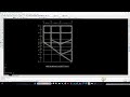
Site Suitability Analysis in ArcGIS | Health Center Location GIS Tutorial | Lec-13
Welcome to **Lecture 13 of the ArcGIS GIS Tutorial Series**.
In this video, I demonstrate how to perform **Site Suitability Analysis in ArcGIS** for selecting the best location for a **new Health Center** using GIS spatial analysis techniques.
Suitability analysis is widely used in **urban planning, infrastructure development, and civil engineering projects** to determine the most appropriate locations based on multiple criteria.
🎓 Instructor: Sakib
🏫 Civil Engineering, Ahsanullah University of Science and Technology (AUST)
In this lecture we apply the following GIS criteria for selecting a health center location:
• Within 30 m distance from nearby roads
• Within 100 m distance from religious places
• Beyond 150 m distance from existing health centers
• Beyond 120 m distance from educational institutes
• Within 60 m distance from parks
Using these criteria, we perform spatial analysis in **ArcGIS** to identify suitable locations for establishing a new health center.
Software used:
ArcGIS
This **GIS tutorial series** helps beginners learn practical GIS workflows used in **mapping, spatial analysis, urban planning, and civil engineering applications**.
#ArcGIS
#GIS
#SuitabilityAnalysis
#SiteSelection
#SpatialAnalysis
#ArcGISTutorial
#CivilEngineering
Видео Site Suitability Analysis in ArcGIS | Health Center Location GIS Tutorial | Lec-13 канала MNH METHODS
Комментарии отсутствуют
Информация о видео
10 марта 2026 г. 18:03:34
00:31:19
Другие видео канала