Advanced GIS mapping in R
In this fast-paced webinar, we show how to create inset maps, faceted maps, animated maps, interactive mapping applications, cartograms, raster maps, and bridge over from R to QGIS thanks to the packages sf, tmap, raster, leaflet, shiny, ggplot2, ggmap, grid, mapview, cartogram, and qgisprocess.
To view / download the slides from this presentation, visit:
https://westgrid.github.io/trainingMaterials/domains/geo/
For information on other WestGrid events, visit: https://www.westgrid.ca/events
Connect with WestGrid:
Mailing List - http://eepurl.com/dusEGr
Website - https://www.westgrid.ca
Twitter - @WestGrid
Training Enquiries - training@westgrid.ca
Technical Support - support@westgrid.ca
Видео Advanced GIS mapping in R канала WestGrid
Показать
Комментарии отсутствуют
Информация о видео
Другие видео канала
 Intermediate VMD topics - Trajectories, movies, scripting
 Make Your Own Interactive Map of COVID-19 Spread Using R Shiny
 Automating your backups in Linux and MacOS
 Workflows with Programmable Filter & Source in ParaView
 Linking databases to code repositories with Throughput
 How to speak so that people want to listen | Julian Treasure
 Natural Language Processing in Python
 Scientific visualization on NVIDIA GPUs
 Plot Spatial Data / Shapefiles in R | Gun Violence in Chicago
 Basics of GIS mapping in R
 Mastery: How to Learn Anything Fast | Nishant Kasibhatla
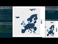 R tutorial: Creating Maps and mapping data with ggplot2
 Clusterstats
 R language tip: Create maps in R
 The first 20 hours -- how to learn anything | Josh Kaufman | TEDxCSU
 Working with multidimensional datasets in xarray
 Swift Programming Tutorial for Beginners (Full Tutorial)
 Using Singularity containers in VMs and HPC webinar by WestGrid
 Carsten Laukamp - Remote sensing for mineral exploration
 Parallel Julia webinar