Leica RTC360 & Robot Boston Dynamics Spot
▷ Solución de captura de la realidad para una variedad de industrias. Al combinar el robot móvil ágil Spot de Boston Dynamics con el escáner láser 3D Leica RTC360 probado en la industria, el tiempo de escaneo empleado por los operadores humanos se reduce significativamente al programar los dispositivos para repetir rutas de escaneo automatizadas a través de los sitios.
Más información:
▷ESPAÑA: https://grupoacre.es/catalogo-productos/leica-rtc360-para-robot-movil-boston-dynamics-spot/
▷PORTUGAL: https://grupoacre.com.pt/catalogo-productos/leica-rtc360-para-robot-movil-boston-dynamics-spot/
▷PERÚ: https://grupoacre.pe/catalogo-productos/leica-rtc360-para-robot-movil-boston-dynamics-spot/
▷PANAMÁ: https://grupoacre.pa/catalogo-productos/leica-rtc360-para-robot-movil-boston-dynamics-spot/
▷COLOMBIA: https://grupoacre.co/catalogo-productos/leica-rtc360-para-robot-movil-boston-dynamics-spot/
#RealityCapture #LaserScanning #LeicaRTC360 #3DRealityCapture #AutonomousScanning #BostonDynamics #Spotthedog @LeicaGeosystemsCH
Видео Leica RTC360 & Robot Boston Dynamics Spot канала Acre Surveying Solutions
Показать
Комментарии отсутствуют
Информация о видео
Другие видео канала
 Topografía con Mobile Mapping en ACRE España. Captura de datos Proyecto Toledo
 Documentación de Patrimonio Cultural en el Castillo de Almenara con drones
 Leica Infinity Software para Leica NOVA
 ACRE DJI Academy "Fotogrametría"
 Video de lanzamiento LiDAR DJI Zenmuse L2
 Antena Zeno FLX100 de Leica Geosystems a prueba en fachadas
 Pix4Dreact Software de mapas rápidos 2D
 Nuevo Láser Escáner #BLK360
 Leica Cyclone FIELD 360 Software de control de láser escáner
 Presentación oficial en directo DJI Dock 2 Madrid
 DJI MATRICE 300 RTK
 Flujo de trabajo con láser escáner y Leica Cyclone FIELD
 Dron DJI Matrice 300 RTK
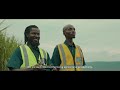 Drones para agricultura DJI AGRICULTURE | DISTRIBUIDOR OFICIAL ACRE
 ▷ Primer vuelo con Zenmuse L1 el LiDAR para dron de DJI
 ACRE Surveying Solutions.
 Estaciones Totales Manuales iCON iCB50 iCB70
 CM174. Medidor de tenaza termográfico de 600 A CA/CC
 Leica Zeno 20. Solución GIS inteligente
 ▷ Antena ultracompacta Leica Zeno FLX100