DEM analysis in ENVI
remotesensing , GIS, statistics, english, envi, excel,
Видео DEM analysis in ENVI канала litan mohanty
Видео DEM analysis in ENVI канала litan mohanty
Показать
Комментарии отсутствуют
Информация о видео
Другие видео канала
 class image creation, thershold in ENVI, opening of data both in ENVI and ArcGIS at a time part 1
 how to install and downlode SPSS software
 delete unrequired field from shap file
 ISO DATA CLASSIFICATION 1, ENVI
 proximity analysis, selection, buffer, union, merge, intersect, erase
 Extraction of required areas
 Scatter plot, basics envi 2
 class image creation, thershold in ENVI, opening data ENVI to ArcGIS part 3
 logistic regression in SPSS
 plotting graph in GIS
 Thersholding in Erdas imagine software for land and water discrimination
 Raster calculator
 SPECTRAL INDICES, ENVI, ndsi
 model making in GIS
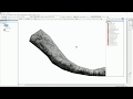 Map composition in GIS
 Hydrology tool use
 TOPOGRAPHIC parameters derivation in saga gis
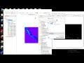 class image creation, thershold in ENVI, opening of data both in ENVI and ArcGIS at a time part 2
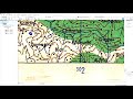 Georeferencing of toposheet in ArcGIS
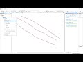 line to multiple points 1