Earth Resources Technology Satellite (ERTS) - 1973
The Google Earth of its day, the Landstat satellites didn't look out into space, they looked down on earth, helping scientists to predict famine, study urban development, and better understand the planet we call home.
SUMMARY
This film shows how the Earth Resources Technology Satellite helped meet the need to provide a worldwide survey of earth resources to help scientists and governments plan their use and conservation. U.S. scientific investigators explain how they were using ERTS (later renamed Landsat) images to identify crops, forests, and grass lands, study urban development, determine the boundary of wetlands, identify geological features that may lead to mineral and fuel deposits, and monitor disasters including volcanic eruptions and floods.
This film won the Bronze Medal Award at the Atlanta Film Festival, 1973.
Transcript (PDF): http://archives.gov/social-media/transcripts/transcript-earth-resources-technology-satellite-649405.pdf
CREATED BY
National Aeronautics and Space Administration. (10/01/1958 - )
REPOSITORY:
Contact(s): National Archives at College Park - Motion Pictures (RDSM), National Archives at College Park, 8601 Adelphi Road
College Park, MD 20740-6001
Phone: 301-837-3540, Fax: 301-837-3620, Email: mopix@nara.gov
For information about ordering reproductions of moving images held by the Motion Picture, Sound, and Video Records Section, visit: http://www.archives.gov/research/order/broadcast-quality-film-dc.html
SUBJECTS
Astronautics
Earth sciences
Boldt, Joseph R., author of screenplay
Allan, Ken, narrator
Burns, Frank, director
Etheridge, James B., film producer
Margolin, Murray, film editor
Audio Productions, producer
MORE INFORMATION:
More information is available in the National Archives online catalog:
https://catalog.archives.gov/id/649405
Видео Earth Resources Technology Satellite (ERTS) - 1973 канала US National Archives
Показать
Комментарии отсутствуют
Информация о видео
Другие видео канала
 2019 Virtual Genealogy Fair Session 1: Exploring History Hub for Genealogists and Researchers
 Come "Inside the Vault" with the National Archives in a New Series of Monthly Public Programs
 My Prairie Cookbook: Memories and Frontier Food from My Little House
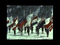 Winter Olympics, 03/22/1961
 FRC Scanning Services for Federal Agencies
 Matthew Wasniewski - Hispanic Americans in Congress 1822 - 2012
 ISOO - CUI Briefing - January 27, 2017
 National Archives exhibit tour: MAKING THEIR MARK
 2019 Virtual Genealogy Fair Session 4: World War I Naval and Marine Corps Records
 Genealogy Introduction—Military Research at the National Archives: Volunteer Service
 The National Archives on Jeopardy!
 Citizen Archivists: Engage with and Explore the Archives
 Civil War letter by Walt Whitman discovered in National Archives
 Political Rules Of The Road
 The Big Picture - The General George S. Patton Story
 Controlled Unclassified Information: Destruction of CUI
 The Annual Move
 The McGowan Forum - Web 2.0 Technologies and Participatory Democracy
 Virtual Genealogy Fair 2015, Day 1 of 2 (broadcast 2015 Oct. 21)
 Women in Defense, 1941
 Madison’s Hand: Revising the Constitutional Convention