Ponta de Sao Lourenco, Madeira
Ponta de Sao Lourenco Madeira, Prainha Beach, Canical, Miradouro da Ponta do Rosto, PR8 Vereda da Ponta Sao Lourenco Hiking Trail, Sardinha Beach, Miradouro Ponta do Furado
Ponta de São Lourenço (Portuguese for the "Point of Saint Lawrence") is the easternmost point of the island of Madeira. It is inside the town of Caniçal and forms a part of the municipality of Machico. Its terrain are made up of rocks and herbaceous vegetation. Since 1982, the headland is a nature reserve, where it has the conservation of its endemic plants and it has fauna, including birds, insects, and molluscs. Marine fauna are in the waters surrounding the headland.
Northeast of the islet is Porto Santo, and southeast is Bugio and the Deserted Islands. Nearby are a few islets with the easternmost being Ilhéu do Farol (Farol Islet), where its nearby lighthouse is located.
The headland's highest point is Pico do Furado.
Source:
https://en.wikipedia.org/wiki/Ponta_de_S%C3%A3o_Louren%C3%A7o
Recorded: September 2021 by Radek7001
Music:
Licensed via artlist.io
https://artlist.io/Radoslaw-520173
Видео Ponta de Sao Lourenco, Madeira канала Radek7001
Показать
Комментарии отсутствуют
Информация о видео
Другие видео канала
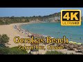 Gerakas Beach, Vasilikos, Zakynthos, Greece
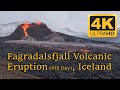 Fagradalsfjall Volcanic Eruption (6th Day of Eruption)
 Hamrahlid Iceland
 Porto da Cruz, Madeira Island
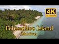 Fehendhoo Island Maldives
 Azores Portugal
 ICELAND, Summer 2023, Southwest
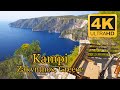 Kampi, Zakynthos, Greece
 Akaka Falls State Park, Hawai'i Island or Big Island, Hawaii
 Cueva De Candelaria, La Palma Island
 Santorini Oia Greece 4K
 Turyn 2012 FHD
 Dubai Marina
 Kauai Island, Hawaii, USA 4K (UHD)
 Oahu Island, Hawaii West, East & North Shore
 Santorini Greece 4K
 Grabrok Crater, Iceland
 Asterix Parc Grzmot Zeusa 2011 FHD
 Dubai Waterpark Aquaventure
 Dubai Tanczace Fontanny