- Популярные видео
- Авто
- Видео-блоги
- ДТП, аварии
- Для маленьких
- Еда, напитки
- Животные
- Закон и право
- Знаменитости
- Игры
- Искусство
- Комедии
- Красота, мода
- Кулинария, рецепты
- Люди
- Мото
- Музыка
- Мультфильмы
- Наука, технологии
- Новости
- Образование
- Политика
- Праздники
- Приколы
- Природа
- Происшествия
- Путешествия
- Развлечения
- Ржач
- Семья
- Сериалы
- Спорт
- Стиль жизни
- ТВ передачи
- Танцы
- Технологии
- Товары
- Ужасы
- Фильмы
- Шоу-бизнес
- Юмор
POV: WHAT IS CELESTIAL NAVIGATION AND CELESTIAL SPHERE!
POV: WHAT IS Celestial Navigation – The Celestial Sphere!
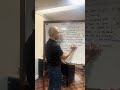
Celestial navigation uses the positions of the Sun, Moon, planets, and stars to find location, while the celestial sphere is the imaginary sphere where these bodies are projected to make calculations, acting as a celestial map with coordinates like declination (celestial latitude) and Greenwich Hour Angle (celestial longitude). It's a fundamental concept for this technique, allowing navigators to plot positions without modern electronics by measuring angles to stars with tools like a sextant.
Celestial Navigation
Definition: A method of determining location (latitude and longitude) by observing celestial bodies.
How it works: Navigators measure the angle (altitude) of a celestial body above the horizon, use time (Greenwich Civil Time), and consult nautical almanacs to find their position, often plotting a "line of position" (LOP) on a chart.
Tools: Historically used sextants, octants, and nautical tables; remains a backup to GPS.
Core Principle: All celestial bodies are assumed to be on the inner surface of the celestial sphere, simplifying position-finding.
Celestial Sphere
Definition: An imaginary, infinitely large sphere concentric with Earth, onto which all celestial objects are projected as if they are at the same distance.
Purpose: A conceptual model to map celestial positions, much like latitude and longitude map Earth's surface.
Key Features:
Zenith: The point directly overhead the observer.
Horizon: The plane tangent to Earth at the observer's location, dividing the visible sky.
Celestial Equator: Projection of Earth's equator.
Declination: Analogous to latitude (degrees north or south of the celestial equator).
Greenwich Hour Angle (GHA): Analogous to longitude (degrees west of the prime meridian).
Thank you! #ConcernedProfessor
📸 D/Cdt Fontamillas
#fyp #SEAMAN #youtubeshorts
Видео POV: WHAT IS CELESTIAL NAVIGATION AND CELESTIAL SPHERE! канала Prof. Kris Minion
Комментарии отсутствуют
Информация о видео
8 января 2026 г. 9:05:30
00:01:29
Другие видео канала