- Популярные видео
- Авто
- Видео-блоги
- ДТП, аварии
- Для маленьких
- Еда, напитки
- Животные
- Закон и право
- Знаменитости
- Игры
- Искусство
- Комедии
- Красота, мода
- Кулинария, рецепты
- Люди
- Мото
- Музыка
- Мультфильмы
- Наука, технологии
- Новости
- Образование
- Политика
- Праздники
- Приколы
- Природа
- Происшествия
- Путешествия
- Развлечения
- Ржач
- Семья
- Сериалы
- Спорт
- Стиль жизни
- ТВ передачи
- Танцы
- Технологии
- Товары
- Ужасы
- Фильмы
- Шоу-бизнес
- Юмор
New Satellite Images Show Trail of Destruction After Deadly UPS Plane Crash
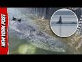
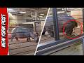
Shocking satellite images reveal the path of destruction left by the UPS cargo plane that crashed and bust into flames in Kentucky on Wednesday, leaving at least 12 people dead, including a child. The before-and-after photos from Vantor, a satellite and data intelligence company, show a long black trail of scorched debris and torched vehicles at an industrial area just south of Muhammad Ali International Airport in Louisville. The images also showed a massive 300-foot gash on the top of a UPS warehouse that was struck by the plane as it came down shortly after takeoff from the company’s aviation hub.
The New York Post is your source for breaking news, news about New York, sports, business, entertainment, opinion, real estate, culture, fashion, and more.
#ups #planecrash #louisville
Check out our two new podcasts:
Pod Force One with MIranda Devine (weekly): https://www.youtube.com/@PodForce1
NY POSTcast (daily): https://www.youtube.com/@NYPOSTcast
Get The Post’s latest headlines everyday with our Morning Report newsletter:
https://tinyurl.com/NYPOSTSIGNUP
Catch the latest news at http://www.nypost.com.
Follow The New York Post on:
Twitter - https://twitter.com/nypost
Facebook - https://www.facebook.com/NYPost
Видео New Satellite Images Show Trail of Destruction After Deadly UPS Plane Crash канала New York Post
Комментарии отсутствуют
Информация о видео
6 ноября 2025 г. 17:42:15
00:02:18
Другие видео канала