How Leonardo da Vinci made a "satellite" map in 1502
It was a feat of technological and symbolic imagination. And it was pretty accurate, too.
Join the Video Lab to see Phil's Q&A! http://bit.ly/video-lab
Leonardo da Vinci’s known for his art and inventions — but also his groundbreaking maps, like this one of Imola, Italy. In this episode of Vox Almanac, Vox’s Phil Edwards explores how it was made.
Further reading:
1) John Pinto’s History of the Ichnographic City Plan is useful to understand the history of these maps.
2) Check out Portraying the City in Early Modern Europe: Measurement, Representation, and Planning by Hilary Ballon and David Friedman for more info.
3) If you want to dig deeper into early maps, Jessica Maier’s Mapping Past and Present: Leonardo Bufalini’s Plan of Rome is fascinating.
Please email Phil if you have trouble finding any of these papers.
Drafting 1502’s equivalent to a “satellite” map was a massive undertaking, and Leonardo managed to pull it off. His early map helped Italian politcian Cesare Borgia construct an idea of the town of Imola that was far more accurate than most contemporary maps. Through the use of careful measurements of angles and pacing out distances using a primitive odometer, Leonardo managed to create a map that was very close to accurate.
This map — an “ichnographic” map — was a step forward in portraying how maps could work to represent geography. Though it’s marked with some inaccuracies, it’s stunningly precise for the time and pushed forward the art of mapmaking. Leonardo’s Imola remains, even today, a remarkably useful guide to the city.
In Vox Almanac, Senior Producer Phil Edwards explains the world through history's footnotes.
Watch all of Vox Almanac here: https://www.youtube.com/watch?v=4dgzJQsAXfI&list=PLJ8cMiYb3G5dDYkBwaRB-0rp6GJ5vnMTe
Vox.com is a news website that helps you cut through the noise and understand what's really driving the events in the headlines. Check out http://www.vox.com.
Watch our full video catalog: http://goo.gl/IZONyE
Follow Vox on Facebook: http://goo.gl/U2g06o
Or Twitter: http://goo.gl/XFrZ5H
Видео How Leonardo da Vinci made a "satellite" map in 1502 канала Vox
Показать
Комментарии отсутствуют
Информация о видео
Другие видео канала
 How the Mona Lisa became so overrated
 Why this black hole photo is such a big deal
 Da Vinci's Vitruvian Man of math - James Earle
 Why American public transit is so bad | 2020 Election
 The lost neighborhood under New York's Central Park
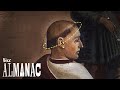 Why monks had that haircut
 Egypt's Dam Problem: The Geopolitics of the Nile
 How the BBC makes Planet Earth look like a Hollywood movie
 It's not you. Bad doors are everywhere.
 Leonardo da Vinci machines tested
 Why all world maps are wrong
 How America could lose its allies | 2020 Election
 What did Leonardo da Vinci's "Last Supper" really look like? | DW Documentary
 This plane could cross the Atlantic in 3.5 hours. Why did it fail?
 The British Museum is full of stolen artifacts
 The technology that’s replacing the green screen
 How this border transformed a subcontinent | India & Pakistan
 Why parrots can talk like humans
 Leonardo da Vinci
 The DeLorean paradox: how it failed and became a legend