Real Time GIS
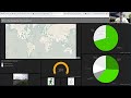
Real-Time GIS analyzes sensor data and other live feeds, performs continuous processing, and puts data on interactive maps for real-time decision-making. In this session, you will learn how to provide better situational awareness, improve your response times to incidents, and dynamically track entities that are constantly changing location (such as vehicles, aircraft, or vessels). Make sense of massive amounts of dynamic data with ArcGIS GeoEvent Server, ArcGIS Velocity, and ArcGIS Dashboards
For more information, please visit: http://ow.ly/YRSt50D9Gjp
---------------------------------------------------------------------------------------------------
Follow us on Social Media!
Twitter: https://twitter.com/Esri
Facebook: https://facebook.com/EsriGIS
LinkedIn: https://www.linkedin.com/company/esri
Instagram: https://www.instagram.com/esrigram
The Science of Where: http://www.esri.com
Видео Real Time GIS канала Esri Industries
Показать
Комментарии отсутствуют
Информация о видео
Другие видео канала
 Linking Survey123, Web Maps, Story Maps, and Dashboards
 ArcGIS GeoEvent Server: Leveraging Real-Time GIS
 Learn GIS and ArcGIS software fast and practical
 App Challenge 2021 - Introduction to Web AppBuilder for ArcGIS
 GIS: Mapping your World
 IA3 - Creating a Dashboard Map for StoryMap
 CORS NETWORKS: Chapter 1 of 2 - Learn how data is transferred
 Operations Dashboard for ArcGIS
 Telecommunication Webinar: Enabling Real Time GIS monitoring & IoT with ArcGIS
 GeoEvent Server: Real-Time GIS
 NASA ARSET: Groundwater Monitoring using Observations from NASA’s GRACE Missions
 Upload #Shapefile in #MySQL as Spatial Data | #QGIS | #FWTools | GIS & IT Tools
 How to Use ModelBuilder in ArcGIS to Automate Geoprocessing
 Thematic Mapping: 101 Inspiring Ways to Visualize Empirical Data | Official Book Trailer
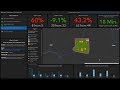 Creating Dynamic, Real-Time Maps with Operations Dashboard for ArcGIS
 Build a Dispatch App with AppSheet and Google Sheets
 Operations Dashboard for ArcGIS: An Introduction
 Parcel Fabric: Migrating and administrating parcels with ArcGIS Pro
 Power BI Streaming Real Time Dashboards in 10 minutes - DIY -40-of-50