DriX, the Revolutionary iXblue Unmanned Survey Vessel
https://ixblue.com.au - Our unique unmanned vessel Drix has revolutionised hydrographic surveying.
DriX has been designed with the absence of Human factor as a fundamental, from launch and recovery to mission’s execution. Fast, enduring, safe, high seas going and sea proven, it shows
outstanding sea-keeping capabilities and takes the industry of surface drones several steps further.
At 7.7m long, Drix has a 0.7m beam, 2m keel, 37.5 hp diesel engine, 250l fuel tank and displacement of 1.4 tons; Drix can motor at over 10 knots.
Check out full specifications, details of the projects undertaken with Drix, and the remarkable results achieved. https://ixblue.com.au/equipment-2/vessels/drix-unmanned-survey-vessel/
iXblue provides hydrographic surveys in accordance with stringent International Hydrographic Organisation (IHO) standards or equivalent.
Our teams of highly experienced and accredited hydrographers conduct surveys globally for Government agencies, the Oil & Gas, Energy, Telecommunications and Marine Renewables sectors. Accurate surveying is crucial for the production of nautical charts that are relied upon by mariners around the world for safe navigation and protection of the marine environment.
Our team has extensive experience in the planning, collection, processing and reporting of data needed to meet the strict guidelines set by government hydrographic authorities.
Since 2008 we have provided nautical charting services to Land Information New Zealand. With the award of eight major projects, we’ve surveyed over 30,000 Nm with high resolution multi-beam echo sounder and delivered quality data for the production of official New Zealand nautical charts.
Видео DriX, the Revolutionary iXblue Unmanned Survey Vessel канала iXblue Pty Ltd
Показать
Комментарии отсутствуют
Информация о видео
Другие видео канала
 Kaikoura Post Earthquake Survey // iXblue
 Sound Velocity Profiling // iXblue // Marine Survey Specialists
 Using a drone to map shallow areas after Kaikoura Earthquake | iXblue
 IXBLUE Australia Case Study // Doubtless Bay - New Zealand (Marine Survey)
 Target Detection Check // iXblue // Marine Survey Specialists
 IXBLUE // Marine Survey Specialists
 Our Story // IXBLUE Australia // Marine Survey Specialists
 Team Profile: Owen Friedlieb - IXBlue Australia
 IXBLUE // The depths of the ocean through the eyes of our ROV, Thalassa
 Project Phase: Pre-mobilisation // iXblue // Marine Survey Specialists
 Team Profile: Dave Donohue // IXBLUE // Marine Survey Specialists
 How iXblue is Significantly Reducing Survey Costs
 Sound Velocity Probes //iXblue // Marine Survey Specialists
 IXBLUE Australia Case Study // Auckland Islands - New Zealand (Marine Hydrographic Survey)
 What is Dimensional Control? // iXblue // Marine Survey Specialists
 Team profile: David Donohue - MD - IXBLUE Australia
 IXBLUE // Marine Survey Specialists
 iXblue Hydrographic Survey in Doubtful Sound, Fiordland, NZ
 IXBLUE Australia Case Study // Chalky & Preservation Inlets - New Zealand (Marine Survey)
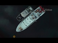 IXBLUE Inertial Navigation System
 IXSURVEY // Marine Survey Specialists