SkyTEM Aquifer Mapping
Wonder where your water comes from when you fill up a glass to quench your thirst? Chances are, it’s from underground water sources called aquifers. Watch how geologists are using a new high-tech rig, towed by helicopter, to detect and map these underground water reserves.
For more of this story: http://science.kqed.org/quest/video/skytem-aquifer-mapping/
Видео SkyTEM Aquifer Mapping канала KQED QUEST
For more of this story: http://science.kqed.org/quest/video/skytem-aquifer-mapping/
Видео SkyTEM Aquifer Mapping канала KQED QUEST
Показать
Комментарии отсутствуют
Информация о видео
Другие видео канала

 Storativity and Specific Storage (Confined Aquifers)
 Groundwater Recharging in Hindi (Env Eng.) Lecturer-6 / Diploma / SSC JE / RRB JE
 Mapping vulnerability of groundwater to contamination using DRASTIC method
 What is an Aquifer?
 How an Aquifer Works
 Converting Buses into Mobile Showers for the Homeless | Engineering Is
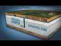 The Ogallala Aquifer
 Searching for an underground water leak
 Unconfined Aquifers vs. Confined Aquifers
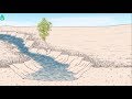 Ancient practices to increase water storage in desert aquifers 💧💦 | Waterpedia #WaterWednesday
 The Ogallala Aquifer
 What is Structural Engineering? | Science Spotlight
 Drones, Mines and Data
 Groundwater Flow Basics
 Groundwater introduction
 FINDING WATER Before You Buy Land
 Mercenary Geologist, Mickey Fulp - Geological Mapping
 FRESH RESULT (1 SYSTEM) LONG RANGE WATER LOCATOR
 Groundwater science. Groundwater contours. 10 common mistakes in hydrogeology. Lesson 11.1.