Working With 250-m NDVI Tiles in Alaska
In this session we will mosaic 250-meter NDVI tiles that cover most of Alaska. First we will mosaic the NDVI tiles and mosaic the pixel reliability tiles.
Then we will extract those pixels with a high reliability value, and a NDVI above 0.2. We will then project these high quality NDVI pixels from the sinusoidal projection into the Alaska Albers NAD83 projection.
We will then investigate the mean NDVI within ecoregion polygons.
Видео Working With 250-m NDVI Tiles in Alaska канала NRM641RemoteSensing
Показать
Комментарии отсутствуют
Информация о видео
Другие видео канала
 Display of 8-bit Panchromatic Images in ArcMap
 Week 3: Exploring Spectral Regions Using ArcGIS
 Querying and Clipping Rasters Using ArcGIS
 Week1: Remote Sensing Applications Using ArcGIS
 The Advanced Very High Resolution Radiometer
 Assessing MODIS NDVI Reliability
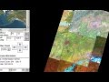 Landsat Sensors
 SWIR Spectral Regions
 Assessing the Precision and Accuracy of LIDAR Ground Elevation Estimates
 Co-registration of Historic Imagery
 Drop Down Animations
 Processing GIMMS-NDVI Rasters
 Mini-Project 6: Decadal Arctic NDVI Response to a Summer Warmth Index
 Assessing eMODIS NDVI Reliability
 Week 10: LIDAR Applications Using ArcGIS
 Hillshade Sharpening of Remotely Sensed Images
 Week7: Using ArcGIS to Work With AVHRR NDVI and Radiant Temperature Data
 Using Landsat Sensor Data to Map Arctic "Greening" 1986 - 2009
 Week2: Using ArcGIS For Image Based Pdf Posters and Animations
 Analysis of Spectral Response Differences