Save Your Life Without SOS #hikingandcamping #besthikes #hikingequipment #hiking #garmin
If you're hiking and have a heart attack, stroke, or fall, and can't hit the SOS button, this feature can save your life.
-----
Garmin inReach is a family of satellite communication devices designed primarily for outdoor adventurers who require a reliable means of communication and navigation when they are outside of traditional cellular service areas. The core of its capability is the integration of the Iridium satellite network, which offers global coverage, ensuring that users can send and receive messages from virtually any corner of the Earth.
The tracking function of the Garmin inReach devices is particularly noteworthy. Once activated, the device can periodically send its location to the Iridium satellite network. These location pings are then relayed to the Garmin servers and can be viewed in real-time or retrospectively by designated contacts or anyone with the shared tracking link. Users can customize the frequency of these tracking intervals, with more frequent updates consuming more battery power.
Safety is another paramount feature of the inReach devices. At the push of a button, users can send an SOS distress signal, which will be received by GEOS, a 24/7 global emergency response coordination center. The center can then coordinate a rescue operation while keeping in touch with the inReach user through two-way text communication. Additionally, when an SOS is initiated, the device will increase its tracking frequency to provide rescuers with more up-to-date location data.
Beyond just tracking, Garmin inReach devices offer two-way messaging, weather forecasts, and GPS navigation, making them a multi-purpose tool for those venturing into remote or challenging environments. However, it's crucial to remember that, like all satellite-based tools, line-of-sight to the sky is often required for optimal performance. Physical barriers like deep canyons or dense forests might sometimes impact the device's ability to connect to the satellite network.
Видео Save Your Life Without SOS #hikingandcamping #besthikes #hikingequipment #hiking #garmin канала HikingGuy.com
Показать
Комментарии отсутствуют
Информация о видео
Другие видео канала
 Horseshoe Bend Hike Guide - Arizona
 How to Get a Mt Whitney Permit
 Mt Whitney Hike Guide
 See the Highest and Lowest Point in the Lower 48 At the Same Time #nature #usa
 BIG NEWS - Is This the End of the Motorola Defy Satellite Link?
 Mos Eisley - Hike to the Viewpoint! #starwars
 Hiking News - January 2024 (Google, Garmin, AllTrails, ChatGPT)
 Smoky Mountains Parking Pass (How-To) #smokymountains
 How to Hite Alum Cave #smokymountains
 Clingmans Dome Hike (How To) #smokymountains
 Did You Know That LA Had TWO Mt Baldys? #hiking #losangeles
 My #1 Hiking Gift After 30 Years on the Trail
 How To Hike Muir Woods Main Loop #muirwoods #sanfrancisco #hiking
 Garmin eTrex Solar - Quick Unboxing #garmin #gps
 Did John Muir Found Muir Woods? #hiking #nationalpark #sanfrancisco
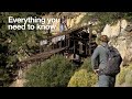 How to Hike Big Horn Mine Trail
 Best inReach for Thru Hikes - #pct #appalachiantrail
 Free Historic Topographic Maps #hiking #hikingandcamping
 How I Organize My Hiking Daypack #hikingandcamping #hiking
 How to Carry Water While Hiking #hikingandcamping #hiking
 Hiking Navigation in Bad Weather #hiking #hikingandcamping