The 2005 Hurricane Season
This animation shows all of the cyclonic activity associated with the 2005 Atlantic hurricane season from June to November. The 2005 hurricane season was a record breaker: the most named storms, three of the six most intense storms on record, the latest forming storm, and the most costly season in property damages. The infrared imagery was captured by the National Oceanic and Atmospheric Administration (NOAA) GOES-12 satellite with 4km resolution. Names of all of the tropical storms and hurricanes are included in the animation.
Видео The 2005 Hurricane Season канала NOAAVisualizations
Видео The 2005 Hurricane Season канала NOAAVisualizations
Показать
Комментарии отсутствуют
Информация о видео
Другие видео канала
 27 Storms: Arlene to Zeta
 What Can We Learn From 2020's Record-Breaking Hurricane Season?
 2005 Hurricane Season
![Hurricane Laura to Rapidly Strengthen Soon [Tuesday Evening Update]](https://i.ytimg.com/vi/Wv7Bckziqw8/default.jpg) Hurricane Laura to Rapidly Strengthen Soon [Tuesday Evening Update]
Hurricane Laura to Rapidly Strengthen Soon [Tuesday Evening Update] 2005 Atlantic Hurricane Season Animation V.5
 Mobbed by Raccoons (25) Tuesday Night 03 Nov 2020
 2020 Atlantic Hurricane Season GOES-16 Infrared Satellite Imagery Animation (HD 1280x720)
 2018 Atlantic Hurricane Season Animation
 Typhoon Wutip - Infrared satellite imagery views
 My House Was Flooded by Hurricane Harvey and I Vlogged the Whole Thing.
 A Year of Weather 2018
 2005 Atlantic Hurricane Season (updated version)
 8/29/2005 Hurricane Katrina, New Orleans, LA - Video on Canal Street - Katrina Raw Master 16
 HURRICANE ZETA - Eyewall Intercept in Louisiana
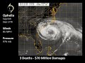 2005 Atlantic Hurricane Season Overview
 How the Universe is Way Bigger Than You Think
 2005 Atlantic Hurricane Season Animation (ThePhoneExpert)
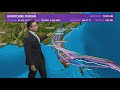 Hurricane Dorian latest forecast path and spaghetti plot
 Modeling the Future of Our Ocean
 The Weather Channel Hurricane Andrew Part I 1992