- Популярные видео
- Авто
- Видео-блоги
- ДТП, аварии
- Для маленьких
- Еда, напитки
- Животные
- Закон и право
- Знаменитости
- Игры
- Искусство
- Комедии
- Красота, мода
- Кулинария, рецепты
- Люди
- Мото
- Музыка
- Мультфильмы
- Наука, технологии
- Новости
- Образование
- Политика
- Праздники
- Приколы
- Природа
- Происшествия
- Путешествия
- Развлечения
- Ржач
- Семья
- Сериалы
- Спорт
- Стиль жизни
- ТВ передачи
- Танцы
- Технологии
- Товары
- Ужасы
- Фильмы
- Шоу-бизнес
- Юмор
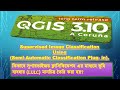
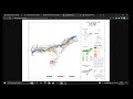
Line on Polygon: Vector Overlay in QGIS | Geography Hons Semester-6 Practical
@eggeography
@eggeography
## Master Vector Overlay in QGIS: Line on Polygon (Step-by-Step Tutorial) 🌍💻
Welcome to this easy and practical GIS tutorial! In this video, we dive deep into one of the most fundamental spatial analysis techniques: **Vector Overlay in QGIS**, specifically focusing on the **Line on Polygon** method.
Whether you are plotting a river flowing through different districts, a highway crossing multiple states, or a railway network, understanding how line and polygon vectors interact is essential for any GIS student or professional. We will be using **Real Vector Maps** to make this practical and easy to follow.
### 🎓 Academic Relevance
This tutorial is specially tailored for **Semester-6** students and strictly follows the **Curriculum & Credit Framework for Undergraduate Courses in Geography (v.1)**.
* **Target Audience:** Geography Honours Practical (GIS) students.
* **University:** Aligned with the University of Calcutta syllabus (Effective from the Academic Session 2023-24).
---
### 📝 What You Will Learn in This Video:
* **Concept Breakdown:** Understanding the simple formula of combining a Line feature + a Polygon feature to get a precise Vector Overlay result.
* **QGIS Interface:** Setting up your layers (Points, Line, Polygon, and Basemap) just like a pro.
* **Practical Application:** Step-by-step execution of the Line on Polygon overlay using real-world vector data.
* **Easy & Practical Methodology:** Clear instructions designed to help you ace your Geography practical exams.
----------------------------------------------------------------------------------------------------------------
Here are the detailed timestamps for the tutorial video, updated to reflect the exact visual steps and tool interactions shown on screen. This breakdown should make it very easy for your Geography Honours students to follow along and quickly jump to specific parts of the practical exercise:
[00:06] Introduction to Vector Overlay & Line on Polygon Concept
[01:31] QGIS Interface Setup: West Bengal District and Railway Layers
[03:55] Processing Toolbox: Selecting and Setting Up the Intersection Tool
[06:08] Verifying the Intersection Output via the Attribute Table
[07:59] Opening the Field Calculator to Measure Railway Length
[11:00] Checking Project Properties for Distance Measurement Units (Meters)
[12:02] Updating the Field Calculator to Convert Lengths from Meters to Kilometres
[14:10] Final Result Analysis: Selecting Features to Verify Individual Segment Lengths
-----------------------------------------------------------------------------------------------------------------
### 📚 Recommended Prerequisites:
Make sure you have a basic understanding of standard Geography topics before diving in, such as:
* GIS Basics
* Cartography
* Remote Sensing
**Don't forget to LIKE, SHARE, and SUBSCRIBE for more easy-to-understand GIS tutorials and Geography Honours practical guides! Hit the notification bell so you never miss an update.**
Drop a comment below if you have any questions about the steps or if you need help with other QGIS tools! 👇
**Tags:**
#QGIS #VectorOverlay #GIS #GeographyHonours #Semester6 #CalcuttaUniversity #GISTutorial #LineOnPolygon #Cartography #RemoteSensing #SpatialAnalysis #Geospatial
Видео Line on Polygon: Vector Overlay in QGIS | Geography Hons Semester-6 Practical канала EGGeography
Комментарии отсутствуют
Информация о видео
30 мая 2026 г. 9:49:34
00:14:51
Другие видео канала