Mapping a Lake with ArduPilot
A slightly long video showing the steps to create a 2D or 3D map of a lake. The vehicle is an EAMS Lab (elab.co.jp) low cost drone boat with a Cube autopilot, ECT400 echosounder from EchoLogger.com and thrusters from BlueRobotics.com. ReefMaster was used to create the 2D and 3D maps.
A blog post is here: https://discuss.ardupilot.org/t/mapping-a-lake-with-ardupilot
Build instructions: https://ardupilot.org/rover/docs/reference-frames-boogieboard-boat.html
Видео Mapping a Lake with ArduPilot канала Randy Mackay
A blog post is here: https://discuss.ardupilot.org/t/mapping-a-lake-with-ardupilot
Build instructions: https://ardupilot.org/rover/docs/reference-frames-boogieboard-boat.html
Видео Mapping a Lake with ArduPilot канала Randy Mackay
Показать
Комментарии отсутствуют
Информация о видео
Другие видео канала
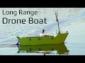 Long Range Autonomous Drone Boat - Build and Tuning
 Arduplane terrain following test
 PixHawk/Mission Planner/ArduPilot Build for Beginners: Introduction
 AtTrac Mapping Boat Test
 Did The Soviet Union Discover Aliens In The Deepest Lake In The World? | UFOs: The Lost Evidence
 Solar Rover #3 - 3D Printed Brushless Gearbox
 MIssion Planner Secrets and Hidden Features
 We built a Self-Driving RC Boat (ArduPilot Rover)
 Easy Ardupilot on Omnibus Series: 1. Introduction and flashing the firmware
 DeSET Drone Boat First Test
 Ardupilot on tiny CC3D revo mini ( ~14g with GPS! ) - part 1
 Lawn Sweeper Track Robot Uses RTK GPS with Pixhawk Autopilot and Ardupilot Mission Planner Rover
 Tiny Waypoint Drone! - 230g Autonomous Wing
 Easy Ardupilot on Omnibus Series: 2. Connecting the pieces and basic setup
 GPS Modules with Arduino and Raspberry Pi
 Autonomous Box Boat - Long Range Waypoint Mission - RCTESTFLIGHT
 Ardupilot Autonomous Soaring - First Test - RCTESTFLIGHT -
 Project Big Dropper
 Autonomous RC Ship - Part 1
 How to make water on a sailboat (and how to build your own watermaker) // Ryan’s tech corner #3