Coordinate System Jargon: geoid, datum, projection
The road to choosing custom projections is not paved with sundrops and lilies. It is time to start learning the nuts and bolts of coordinate systems.
Minute Markers:
-0:27- Geodesy, the geoid.
-1:10- Ellipsoid, geographic coordinate system.
-2:09- Can't effectively measure with ellipsoid.
-3:21- Planar coordinate system.
-3:49- Geodetic datums.
-5:41- Projections.
-6:47- REMEMBER this, degrees vs. linear units.
-7:10- Three types of projections.
-7:32- Recap.
All images included are in the public domain, though the geoid image was originally created here I believe (correct me if I'm wrong):
http://www.esa.int/spaceinimages/Images/2004/10/The_Earth_s_gravity_field_geoid_as_it_will_be_seen_by_GOCE
Видео Coordinate System Jargon: geoid, datum, projection канала Rhumb Line Maps
Показать
Комментарии отсутствуют
Информация о видео
Другие видео канала
 Intro to coordinate systems and UTM projection
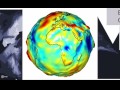 Map Projections
 GOCE: Geoid
 A Simple Explanation of Datum
 Spheroids, Ellipsoid, and Geoid - GIS Fundamentals and Mapping (4)
 surveying with Geoid Models
 Visualizing quaternions (4d numbers) with stereographic projection
 What are Geodetic Datums?
 Geodetic Surfaces and Datums
 Introducing Coordinate Systems and Map Projections
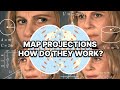 Map Projections Explained - A Beginners Guide
 IMPORTANT DEFINITIONS .GEOID....EELLIPSOID... DATUM...ITRF....WGS84
 500hpa geopotential and sea level pressure animation from Sep. 1, 1999 to Oct. 31, 2010
 Understanding Coordinate Systems and Projections for ArcGIS
 Wissen um 11 - Astrophysik und Weltraumforschung in Bremen heute - PD Dr. Volker Perlick
 Webinario SIRGAS: International Height Reference System (IHRS)
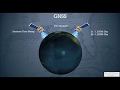 GNSS
GNSS Geographic Datums and Projections in HINDI
 Introduction aux Systèmes Géodésiques