Aerial Mapping - DJI - ODM - QGIS
Ever wanted to take some Aerial Photos, stitch them together to make an orthophoto (georectified image like geotiff) and use the orthophoto for mapping a farm, a Council (municipality) reserve or park, a caravan park or any area to plan layouts, create contours or do measurements? This video shows some free and Open Source ($0) that can be used for this type of mapping.
The video shares a small project that uses a DJI Mavic 2 Zoom to capture aerial photographs, Pix4D for mission planning, Open Drone Map (ODM) to create orthophotography and 3d models and QGIS 3 and Meshlab to display some of the files that ODM creates.
I've used ODM to great effect in the past and I have been very impressed with the orthophotos ODM creates. For this project I wanted to see if flying two missions flown with an offset of about 20 degrees would create better images. So, this video shows how we went about the project and shows what was created by ODM.
-------------------------------------------------
Promotion: Luggage for your drone!
Interested in travel luggage that is waterproof or design specifically for drone owners? Then check out the ReadyProSupply site: https://lddy.no/cll6
If you like what you see then you can get discounts using the following codes:
First time purchases will receive a 15% discount using this code:
READYPROAF15
In future, you will receive a 5% discount on ALL purchases using this code:
READYPROAF5
-------------------------------------------------
The ODM Command used:
vdocker run -it --rm \
-v "$(pwd)/images:/code/images" \
-v "$(pwd)/odm_georeferencing:/code/odm_georeferencing" \
-v "$(pwd)/odm_meshing:/code/odm_meshing" \
-v "$(pwd)/odm_dem:/code/odm_dem" \
-v "$(pwd)/odm_orthophoto:/code/odm_orthophoto" \
-v "$(pwd)/odm_texturing:/code/odm_texturing" \
-v "$(pwd)/opensfm:/code/opensfm" \
opendronemap/odm \
--mesh-size 100000 \
--orthophoto-resolution 1.5 \
--dtm --dem-resolution 2 --smrf-threshold 0.4 --smrf-window 24 \
--dsm \
--pc-csv --pc-las
-------------------------------------------------
Music:
FreeBackgroundMusic
Liam & Vince - Sun of God
https://youtu.be/XQz2McwuXUw
Видео Aerial Mapping - DJI - ODM - QGIS канала Colin Skidmark East
Показать
Комментарии отсутствуют
Информация о видео
Другие видео канала
 3D point clouds from drone imagery -- WebODM, Meshlab, GRASS 7.4
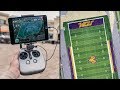 Beginner Tips for Drone Mapping - My Workflow
 What Is An Orthomosaic? Orthomosaic Maps & Orthophotos Explained
 QGIS 3 for Absolute Beginners
 QGIS 4 Arch – A Simple Archaeological Predictive Model
 Photogrammetry/Drone Mapping mistakes you should avoid.
 WebODM How to Install and Run
 DroneCamp 2020: Open Source Data Processing with OpenDroneMap
 5 Killer Ideas for Drone Videos
 Ultimate Pix4D tutorial 3D mapping
 WebODM GCP Interface part2
 Aerial Photogrammetry Explained - Create 3D Models With Drone Photos
 Drone Deploy Mapping Demo Tutorial | DJI Mavic Pro
 A Second Look At WebODM - Open Source Drone Mapping Software
 QGIS in the sky with Diamonds (OpenDroneMap)
 Georeferencing Drone Imagery in QGIS
 DJI Mavic Pro / Air / 2 Pro and Phantom 4 - Make FREE 3D MAPS Using DroneDeploy App
 Aurora Residential Demonstration A - Z
 DJI Mavic Mini || Drone Harmony - 3D Drone Images (FREE)
 Texture Scanning with a DJI Mavic 2 Pro Drone - by Grzegorz Baran