The UTM Grid
A in-depth explanation and illustration of the Universal Transverse Mercator (UTM) grid. This map grid is often used by backpackers and cross-country trekkers. It is the grid of choice for land navigation.
Like this video? If so, you'll want to see my online video course in land navigation. It has around four hours of step-by-step instruction to help you find your way over land. We'll start from the very beginning, and go through some pretty sophisticated techniques. To read more about my course, and to link to it, see this page on my web site:
http://www.land-navigation.com/land-navigation-course.html
Видео The UTM Grid канала FloridaAdventuring
Показать
Комментарии отсутствуют
Информация о видео
Другие видео канала
 Grid Coordinate Systems and UTM
 Understanding Coordinate Systems and Projections for ArcGIS
 Plotting UTM Coordinates with a Grid Tool
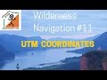 Wilderness Navigation #11 - UTM coordinates
 Intro to coordinate systems and UTM projection
 Basic Land Navigation (Simplified)
 Mapless-Land-Navigation.mp4
 Plotting UTM coordinates, Calculating bearing, and measuring distance
 Determine Longitude
 Converting from grid north to magnetic north
 6 Figure Grid References - Geography Skills
 How to Find Your Position on a Topo Map Using a GPS & UTM
 Map Projections
 How to Plot 8 Digit Grid Coordinates
 UTM, MGRS and location for larger scales
 Map Reading, Map Tools and Markers - Reading and using the Arma 3 Map #Arma3
 UTM: Universal Transverse Mercator
 Wilderness Navigation #10 - Deciphering Declination
 Day and night land navigation tips and tricks
 1:24000 Topographic Mapping Basics (Part I)