Lake Tahoe Then and Now 1870-2015
I recently came across a book published in the early 90's containing old pics of Lake Tahoe communities that were taken between about 1860 to 1990. I came up with the idea of taking pictures myself of the same scene using the same vantage point to see what it looks like today, and assemble the results in a multimedia format in the form of a video slideshow.
To find the original spot where a historic photo was taken, I examined the mountains and horizon in the background, the topography, and architectural landmarks. As a frequent visitor to Lake Tahoe, most scenes were obvious, some required research using Google satellite images and Google maps (Incline Village and Truckee lumber yard), and two were impossible to duplicate (the photographer of the 1920's Pioneer Monument stood in a spot that is now several feet under the I-80 freeway, and Glenbrook is a private gated community so I grabbed pictures from a Web search).
Here are the points of interest that I've selected:
1. Truckee - downtown1
2. Truckee - downtown2
3. Truckee - Spring St
4. McGlashan Mansion
5. Truckee saloon
6. Truckee train depot
7. Truckee lumber mill
8. Donner Lake
9. Pioneer Monument
10. Donner Summit Lodge
11. Tahoe City - Tahoe Inn1
12. Tahoe City - Tahoe Inn2
13. Tahoe City Commons
14. Tahoe City - tree on main street
15. Tahoe City - Watson Cabin
16. Kings Beach - Lake Blvd
17. Kings Beach - east
18. Kings Beach - summer
19. Crystal Bay Casino
20. Cal-Neva
21. Incline Village
22. Glenbrook - aerial
23. Glenbrook - pier
24. Stateline
25. Harvey's Casino
26. Harrah's Casino
27. Hwy50 - Park Ave
28. Hwy50 - Raleys
29. Hwy50 - IHOP
30. Hwy50 - 3rd
31. Lakeland Village
32. Marina Inn
33. Lakeview Commons
Видео Lake Tahoe Then and Now 1870-2015 канала Andy Snowslayer
Показать
Комментарии отсутствуют
Информация о видео
Другие видео канала
 Lake Tahoe In Depth 2D
 Deputy Kills Sheriff in Historic Truckee California
 Revisiting Bonanza's Ponderosa Ranch at Lake Tahoe
 Lake Tahoe, Hunting for lost and tossed treasure!
 Searching the Donner Party's final campsites
 Drive from Reno to Lake Tahoe
 Touring a $44,000,000 Lake Tahoe WATERFRONT Mansion
 Inside a $75M Lake Tahoe Mansion with a Hillside Tram | On the Market | Architectural Digest
 DeepFlight in Lake Tahoe: underwater cliffs exploration with GoPro
 Lake Tahoe Vacation Travel Guide | Expedia
 17 Things to Do in Lake Tahoe in the Summer
 Tragedies of California's 1856 Marsh Mansion
 Lake2o 2020 Official Aftermovie || 4K || South Lake Tahoe, CA
 Old Bonanza set Tahoe
 Lake of the Sky - The Story of Lake Tahoe - Tahoe 101
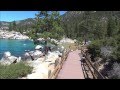 Best beaches of lake Tahoe. Top 5.
 Drive Around Lake Tahoe and Nevada's Capitol - #SUMMER2019 Episode 21
 Tahoe: Reservoir of History Body of Hope
 Mansions No One Wants For Even $1
 15-35: US-50 East through Lake Tahoe to Carson City, NV