- Популярные видео
- Авто
- Видео-блоги
- ДТП, аварии
- Для маленьких
- Еда, напитки
- Животные
- Закон и право
- Знаменитости
- Игры
- Искусство
- Комедии
- Красота, мода
- Кулинария, рецепты
- Люди
- Мото
- Музыка
- Мультфильмы
- Наука, технологии
- Новости
- Образование
- Политика
- Праздники
- Приколы
- Природа
- Происшествия
- Путешествия
- Развлечения
- Ржач
- Семья
- Сериалы
- Спорт
- Стиль жизни
- ТВ передачи
- Танцы
- Технологии
- Товары
- Ужасы
- Фильмы
- Шоу-бизнес
- Юмор
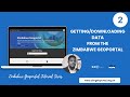
Batch Geocoding
In this tutorial, we are going to be geocoding a batch of addresses which are currently stored in a csv file within our computer. For the purposes of this tutorial we will be using Zimbabwean data which I have also provided a link to below in case you need data to actually practice with.
So we are going to geocode these addresses, plot them to our map and add some popups to it which will contain some small details and then finally we create a local file which has the coordinates (lon and lat) for these Districts.
Some Online Resources.
Here are some resources which will help you easily navigate through this tutorial.
Source Data: https://github.com/African-Surveyors-Connect/LearnArcGIS/blob/main/ArcGIS%20API%20for%20Python/data/geocoding_data_set.csv
Source Code: https://github.com/African-Surveyors-Connect/LearnArcGIS/blob/main/ArcGIS%20API%20for%20Python/Batch%20Geocoding.ipynb
Tutorial Script: https://github.com/African-Surveyors-Connect/LearnArcGIS/blob/main/ArcGIS%20API%20for%20Python/Publications/Batch%20Geocoding%20(with%20ArcGIS%20Python%20API).pdf
Видео Batch Geocoding канала GeoConnect
Комментарии отсутствуют
Информация о видео
14 марта 2021 г. 0:12:19
00:39:37
Другие видео канала