- Популярные видео
- Авто
- Видео-блоги
- ДТП, аварии
- Для маленьких
- Еда, напитки
- Животные
- Закон и право
- Знаменитости
- Игры
- Искусство
- Комедии
- Красота, мода
- Кулинария, рецепты
- Люди
- Мото
- Музыка
- Мультфильмы
- Наука, технологии
- Новости
- Образование
- Политика
- Праздники
- Приколы
- Природа
- Происшествия
- Путешествия
- Развлечения
- Ржач
- Семья
- Сериалы
- Спорт
- Стиль жизни
- ТВ передачи
- Танцы
- Технологии
- Товары
- Ужасы
- Фильмы
- Шоу-бизнес
- Юмор
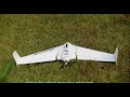
How do you generate a surface from a point cloud in Aplitop Tcp PointCloud Editor
In this video we will explain how to generate a surface in Aplitop Tcp PointCloud Editor from a point cloud.
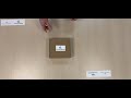
We start by creating a new project and importing a point cloud generated by a photogrammetry application, from photographs taken by a drone. We set the symbology of the points according to the categories, since the points have been provisionally classified. Next, we proceed to create the surface with all the points and we can verify that there are regions that have not been modeled correctly, since points belonging to buildings, streetlights and others that are not part of the ground have been included. Next, we edit the properties of the categories, leaving only the terrain and road surface categories as vertices to create the surface. Now we generate a new surface with only the triangulated points and we see that the result is correct.
Tcp PointCloud Editor allows to display, edit and analyse clouds of millions of points captured by fixed or mobile scanners, LiDAR technology or generated by photogrammetry applications. Point clouds can be imported in the most common formats on the market. Points can have attributes of color, intensity, time, and category, and be represented based on these properties. You can apply offsets, rotations, or transformations to clouds, as well as register them using control points.
You can also generate and analyse surfaces and grids, calculate profiles and volumes, draw with a simple CAD on the point cloud, etc. It offers multiple options for importing and exporting formats such as LandXML, IFC, DWG, 3D PDF, etc.
Order here your own Aplitop Tcp PointCloud editor Software!
https://globalgpssystems.com/aplitop-tcp-pointcloud-editor/
Bestel hier uw eigen Aplitop Tcp PointCloud editor!
https://surveyinghub.nl/software/aplitop-tcp-pointcloud-editor/
Join our community forum to seek and share your knowledge ;)
https://community.surveyinghub.com/
Видео How do you generate a surface from a point cloud in Aplitop Tcp PointCloud Editor канала Global GPS Systems
aplitop software helop ihow fo you use apltiop point cloud software how do you use point cloud software how do you use Point cloud editor point cloud editor tutorial point cloud software guide how can i make a project in aplitop in point cloud cloud point software Tcp point cloud editor editor point cloud edit point clou edit point cloud cloud point edit how do you register points how do i register points how do i regiser point cloud how to assign a orthophoto
Комментарии отсутствуют
Информация о видео
5 января 2022 г. 13:43:44
00:03:35
Другие видео канала