AVISO: HURACAN ZETA entra en Luisiana con categoría 2. Actualización
El Huracán ZETA está llegando a las costas del sureste de Luisiana con categoría 2. Sus vientos son de 177 km/h o 110 millas, y su velocidad de traslación es de 20 millas o 32 km/h. Su presión es de 972 hPa.
Se espera una marejada ciclónica de 9 pies o 3 metros y se han dado avisos de tornados en toda la zona del sureste de Luisiana, costa de Alabama y Misisipi.
La marejada ciclónica puede ser de 9 pies o 3 metros de altura.
AVISO POR TORNADOS
Area: Breton Sound; Chandeleur Sound; Coastal Waters from Boothville LA to Southwest Pass of the Mississippi River out 20 nm; Coastal Waters from Port Fourchon LA to Lower Atchafalaya River LA out 20 nm; Coastal waters from Okaloosa-Walton County Line to Pensacola FL out 20 NM; Coastal waters from Pascagoula Mississippi to Stake Island out 20 NM; Coastal waters from Pensacola FL to Pascagoula MS out 20 NM; Coastal waters from the Southwest Pass of the Mississippi River to Port Fourchon Louisiana out 20 NM; Lake Borgne; Lake Pontchartrain and Lake Maurepas; Mississippi Sound; North Mobile Bay; Pensacola Bay Area including Santa Rosa Sound; Perdido Bay Area; South Mobile Bay; Western Choctawhatchee Bay
AVISO POR HURACAN
Breton Sound; Chandeleur Sound; Coastal Waters from Boothville LA to Southwest Pass of the Mississippi River out 20 nm; Coastal Waters from Port Fourchon LA to Lower Atchafalaya River LA out 20 nm; Coastal Waters from Stake Island LA to Southwest Pass of the Mississippi River from 20 to 60 nm; Coastal waters from Pascagoula Mississippi to Stake Island Louisiana out 20 to 60 NM; Coastal waters from Pascagoula Mississippi to Stake Island out 20 NM; Coastal waters from Port Fourchon Louisiana to Lower Atchafalaya River LA from 20 to 60 NM; Coastal waters from Southwest Pass of the Mississippi River to Port Fourchon Louisiana from 20 to 60 NM; Coastal waters from the Southwest Pass of the Mississippi River to Port Fourchon Louisiana out 20 NM; Lake Borgne; Lake Pontchartrain and Lake Maurepas; Mississippi Sound
Temporada de huracanes 2020
Fuente: https://www.windy.com/
Видео AVISO: HURACAN ZETA entra en Luisiana con categoría 2. Actualización канала Meteo-Windy
Показать
Комментарии отсутствуют
Информация о видео
Другие видео канала
 CICLONES TROPICALES: 6 Condiciones necesarias para su formación
 INVEST 95E (Posible Ciclón Darby) en el Pacífico
 ¿Qué es el Monzón Mexicano?
 Temperaturas RÉCORD en los TRÓPICOS. ¿Por Qué?
 INVEST 96L y 96E: Dos Posibles C. Tropicales en el Atlántico y Pacífico
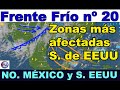 FRENTE FRÍO Nº 20: Afectando al NO. de México y S. de EEUU
 INVEST 90E ¿ROSLYN? POSIBLE HURACÁN A MÉXICO
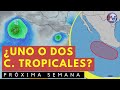 UNO o DOS CICLONES TROPICALES EN EL PACÍFICO Próxima Semana
 Comienza la T. de HURACANES 2023 DEL PACÍFICO O. Aprende Meteorología
 NUEVOS FRENTES FRÍOS y NEVADAS EN BAJA CALIFORNIA
 FRENTE FRÍO Nº 28. El Tiempo en México, Caribe y A. Central
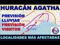 HURACÁN AGATHA: PREVISIÓN DE LOCALIDADES MÁS AFECTADAS
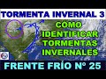 T. INVERNAL 3. FRENTE FRÍO 25. IDENTIFICANDO T. INVERNALES
 Primeros AVISOS de CICLONES TROPICALES en el P. Oriental
 4 Posibles Ciclones Tropicales para la prólxima semana
 POSIBLE HURACÁN en el Atlántico para la próxima semana
 Temporada de Huracanes 2024 - Actualización de Mayo ECMWF
 ¿Por qué el Ciclón BERYL Podrá ser HURACÁN de CAT. 2 en TEXAS?
 Aumenta la probabilidad de un CICLÓN TROPICAL para el fin de semana
 AVISOS por LLUVIAS: Posible C. TROPICAL más Giro Centroamericano
 INVEST 92L en el ATLÁNTICO. Seguimiento de INTENSIDAD y TRAYECTORIA