- Популярные видео
- Авто
- Видео-блоги
- ДТП, аварии
- Для маленьких
- Еда, напитки
- Животные
- Закон и право
- Знаменитости
- Игры
- Искусство
- Комедии
- Красота, мода
- Кулинария, рецепты
- Люди
- Мото
- Музыка
- Мультфильмы
- Наука, технологии
- Новости
- Образование
- Политика
- Праздники
- Приколы
- Природа
- Происшествия
- Путешествия
- Развлечения
- Ржач
- Семья
- Сериалы
- Спорт
- Стиль жизни
- ТВ передачи
- Танцы
- Технологии
- Товары
- Ужасы
- Фильмы
- Шоу-бизнес
- Юмор
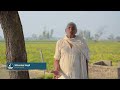
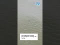
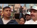
Muzaffarnagar District Drone Survey (RHS) | River Ganga Drainage System Mapping
The project titled “Aerial Survey and Development of GIS-Based Visualization Dashboard with Analytical Module and Geotagged Videography of Drainage System (Natural & Manmade) of River Ganga for the State of Uttar Pradesh” is being executed by GarudaUAV Soft Solutions Pvt. Ltd. under the aegis of Namami Gange Programme. The project aims to undertake aerial LiDAR surveys using helicopters and UAVs for mapping and monitoring drainage systems along the River Ganga in Uttar Pradesh. Advanced photogrammetry, geotagged videography, and GIS-based analytical tools are being utilized to identify and assess all major, medium, and small drains discharging into the river.
The project covers approximately 2,200 sq. km along the Ganga mainstem across 27 districts of Uttar Pradesh, extending up to 200 meters on either side of the river. The proposed GIS-based web application will enable source-to-sink geotagging and visualization of natural and manmade drainage networks through 2D/3D photogrammetry and video analytics.
A key deliverable of the project is the development of a Drain Dashboard and Drain Decision Support System (Drain DSS). The dashboard will facilitate real-time visualization and monitoring of trunk drains, sewage outlets, industrial effluent discharge points, and STP outfalls entering the Ganga basin. By integrating geospatial data with infrastructure and performance metrics, the platform will support hotspot identification, pollution source tracking, prioritization of interventions, and enhanced coordination among state and district-level stakeholders, thereby strengthening implementation under the Namami Gange Programme.
Видео Muzaffarnagar District Drone Survey (RHS) | River Ganga Drainage System Mapping канала Namami Gange
Комментарии отсутствуют
Информация о видео
18 мая 2026 г. 16:13:51
01:14:14
Другие видео канала