- Популярные видео
- Авто
- Видео-блоги
- ДТП, аварии
- Для маленьких
- Еда, напитки
- Животные
- Закон и право
- Знаменитости
- Игры
- Искусство
- Комедии
- Красота, мода
- Кулинария, рецепты
- Люди
- Мото
- Музыка
- Мультфильмы
- Наука, технологии
- Новости
- Образование
- Политика
- Праздники
- Приколы
- Природа
- Происшествия
- Путешествия
- Развлечения
- Ржач
- Семья
- Сериалы
- Спорт
- Стиль жизни
- ТВ передачи
- Танцы
- Технологии
- Товары
- Ужасы
- Фильмы
- Шоу-бизнес
- Юмор
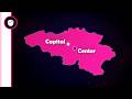
I Tried Searching For the Squiggliest River On Earth - It Broke Me
I tried to answer a surprisingly difficult question: what’s the squiggliest river on Earth? At first glance, it seems simple — just find the curviest one, right? Well good luck with that!
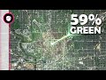
First, I explored global river data using the HydroRIVERS database — a dataset based on elevation and water flow models — and filtered it using discharge values to focus on the most significant rivers. Then I explored OpenStreetMap, as well as another dataset that included named rivers with coordinate data, so I could analyze real river geometries more directly.
To measure squiggliness, I tested two main approaches:
Sinuosity — the ratio between a river's actual length and the straight-line distance between its start and end point.
Average turning angle per unit of distance — capturing how often and sharply a river changes direction.
I processed hundreds of rivers, visualized them in tools like Google Earth, and tried to make sense of the patterns. But let’s just say... things didn’t go quite as expected.
00:00 – Introduction
00:15 – HydroRIVERS
01:50 – OpenStreetMap
02:35 – Unesco Dataset
02:50 – Sinuosity
03:50 – Average turning angle
04:20 – The problems...
HydroRIVERS:
https://www.hydrosheds.org/products/hydrorivers
UNESCO Dataset:
https://ihp-wins.unesco.org/dataset/world-rivers
📷🎷 Stock videos, images, motion graphics and SFX from Envato Elements
Видео I Tried Searching For the Squiggliest River On Earth - It Broke Me канала Geo Data Guy
Комментарии отсутствуют
Информация о видео
31 января 2026 г. 22:00:39
00:07:25
Другие видео канала